I’m stealing this wholesale from the Tumblr site of the U.S. Department of Interior, America’s Great Outdoors.
The site features great Bureau of Land Management (BLM) sites often, and this week will highlight places on BLM lands in California that are great for stargazing. They call it a “social media takeover” of the feed by California BLM.
How good is the star watching? Look at these photographs. (I’ve added a few comments of my own.)

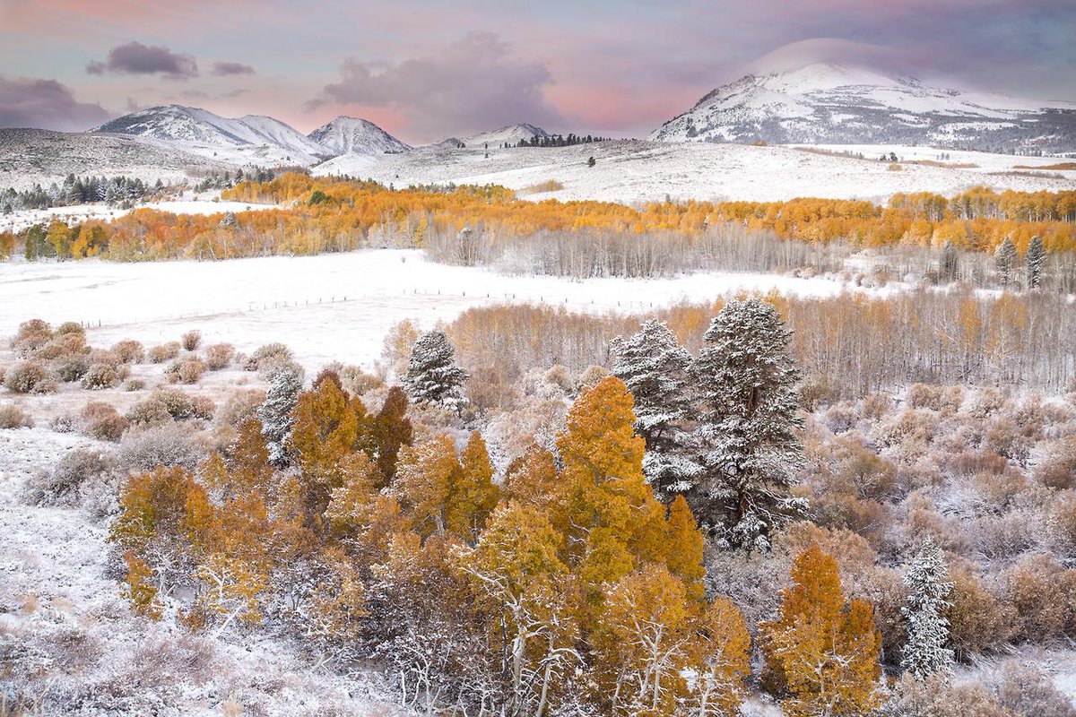
Piper Mountains Wilderness, California, by Bob Wick
Another great place to see the Milky Way.

King Range National Conservation Area, California, by Bob Wick
These photos are stunning. These .gifs also demonstrate how the atmosphere really is a fluid, flowing over mountains — “the curvaceous hills of California,” the Rev. Dr. Martin Luther King, Jr., called them in a travelogue he delivered from the Lincoln Memorial in 1963. Teachers, not just great geography illustrations, but also illustrations for environmental science and physics.

Amargosa Wild and Scenic River, California, by Bob Wick

San Gorgonio Wilderness, California, by Dan Maus

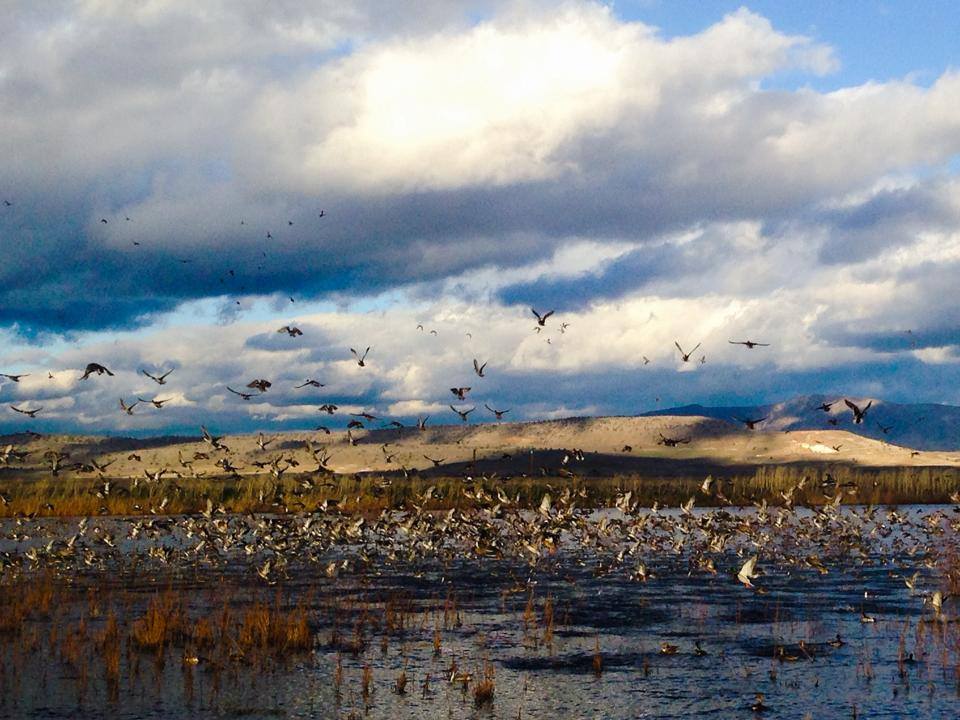
Slinkard Wilderness, California, by Bob Wick
Slinkard Wilderness? I admit I do not know of some of these places. I’m willing to learn, first hand . . .

Kingston Range Wilderness, BLM California, by Bob Wick, BLM

California Coastal National Monument, California, by Bob Wick
California Coastal National Monument reminds me that Republicans in Congress push a proposal to prevent future presidents from protecting such lands with National Monument designation under the Antiquities Act. Critics say these BLM lands are not special enough to merit protection.
Do the photos say otherwise?

North Maricopa Wilderness, California, by Bob Wick

Cadiz Dunes Wilderness, California, by Bob Wick

Point Arena-Stornetta in California Coastal National Monument, California, by Bob Wick
A printer-friendly, and search engine-friendly list of the sites above, if you’re putting them into your GPS or search feature to plan your vacation:
June #conservationlands15 Social Media Takeover: Top 15 Places to Stargaze on the #mypubliclandsroadtrip in BLM California
1. Amargosa Wild and Scenic River
2. Cadiz Dunes Wilderness
3. California Coastal National Monument
4. Carrizo Plain National Monument
5. Fort Ord National Monument
6. Kingston Range Wilderness
7. Little Black Sands Beach in King Range National Conservation Area
8. Lost Coast Trail at King Range National Conservation Area
9. North Maricopa Wilderness
10. Piedras Blancas Light Station Outstanding Natural Area
11. Piper Mountains Wilderness
12. Point Arena-Stornetta in California Coastal National Monument
13. San Gorgonio Wilderness
14. Slinkard Wilderness
15. Whipple Mountains WildernessThanks for following the June #conservationlands15 features on My Public Lands Tumblr, and our takeover of americasgreatoutdoors Instagram account (https://instagram.com/usinterior/). Stay tuned all week as the #mypubliclandsroadtrip visits these top 15 California spots for stargazing and much more.
Bob Wick and Dan Maus may have the best jobs in U.S. government service, judging by their photos. Nice of them to share.
What do your shots from those places look like? Show us in comments, maybe?


 Posted by Ed Darrell