Road trip!

September 19, 2008

A bit unexpectedly, I’m in the wilds of Wisconsin at the moment and on the road the next couple of days.  Posting is likely to be sparse.

But the American open road is, as always, very interesting.

For example, according to the billboards, somewhere in Wisconsin there is a restaurant named Brisco’s (after Brisco County, Texas?), which claims to feature cuisine (a French word) of a “southwestern” flavor.  What does that mean?

Their billboard features a Wyoming-style cowboy, a saguaro cactus (from 800 miles south of Wyoming) in front of Delicate Arch, the signature arch of Arches National Park, near Moab, Utah, (well out of cattle company and still at least 400 miles from saguaro country).  Only on a billboard in Wisconsin . . .


Disaster in Yellowstone Park: 20 years after the fires, it’s healing

September 17, 2008

High school students weren’t alive when Yellowstone burned in 1988. Do you remember?

NASA infrared satellite photograph of Yellowstone fires in 1988

NASA infrared satellite photograph of Yellowstone fires in 1988

It was a conflagration that made hell look like good picnicking. 1988 was a particularly dry summer, and hot. Lightning and human carelessness ignited fires across western North America. Five huge fires raged out of control, and burned huge swaths out of forests in Yellowstone National Park that probably hadn’t seen fire in 80 years, maybe longer.

The Salt Lake Tribune featured several stories about the fires and Yellowstone’s recovery today, “Yellowstone: Back from the ashes,” how wildland firefighting changed, a great chart on fire succession stages, and another chart on the effects of the fire on larger animals in the Yellowstone system.

Old Faithfull erupts against background of smoke from 1988 fires - NPS photo by Deanna Marie Dulen

Old Faithfull erupts against background of smoke from 1988 fires - NPS photo by Deanna Marie Dulen

The 1988 fires made history in several ways; it was the first time so many fires had burned simultaneously. Ultimately some of the fires merged into even greater conflagrations. The fires forced the shutdown of tourism and other activities in the Park. Inadequacies in fire fighting equipment, staffing and policies were highlighted and displayed in newspapers and on television for weeks, forcing changes in policies by cities, states and the federal government.

Some good came out of the fires. Much undergrowth and dead wood had choked off plant diversity in some places in the Park. The fires opened new meadows and offered opportunities for some species to expand their ranges.

Scientifically, a lot of information came out of the fires. The mystery of when aspen would seed out was solved — new aspen seedlings appeared in areas where the fires had sterilized the ground with extremely high temperatures that seemed to trigger the seeds to germinate.

Our visits in 1989 offered a lot of opportunities to look at very bleak landscapes.

Yellowstone National Park in 1989, a year after the big fires - Copyright 1989 and 2008, Ed Darrell

Yellowstone National Park in 1989, a year after the big fires - Copyright 1989 and 2008, Ed Darrell

Recover of the forested areas began rather quickly, but will take time to cover over all the scars of the fires.

Other resources:


Lost expedition? Where’s the photos of the “new” Peruvian waterfall?

August 28, 2008

You’d think someone like National Geographic Society would hustle down there to find it.

Whatever happened to the expedition that took off on the trek to photograph what was rumored to be a world-class waterfall newly discovered in Peru?  The cataract was rumored to be among the world’s tallest.

Perhaps a reader who reads Spanish might find some news in the South American newspapers.  Has anyone seen any news?


Spectacular waterfall discovered in Peru – adventurers off to document it

August 16, 2008

Gocta was unknown until a few years ago — to the outside world. Local Peruvians knew about it, but said little. Gocta turned out to be the third highest waterfall in the world

Lightning has struck Peru again: A week ago an expedition left paved-road civilization to document another very high waterfall, perhaps higher than Gocta, whose existence was only recently discovered, outside of local residents — who said nothing because they feared the reaction of the outside world, or they just didn’t think that anyone else would be particularly interested. The expedition includes “representatives of the sub-regional direction of Bagua Grande and Utcubamba, from Utcubamba’s National Institute of Culture, a topographer of the provincial municipality and a cameraman.”

Perus Gocta, the third-highest waterfall in the world - Alberto Pintado photo

Peru's Gocta, the third-highest waterfall in the world - Alberto Pintado photo

A local explorer, Obed Cabanillas Silva, who seems to be coordinating local efforts to make the cataract known, said there are “stone structures” on the path to the waterfall. Could there be undiscovered, uncharted ruins of former How does the rest of the world miss a waterfall higher than a 250-story building? Here’s a Google Earth challenge — how many other giant waterfalls are there in Peru, “undiscovered” by the rest of the world? Remember the recent discovery of an impact crater in Australia?

The expedition of “discovery” set off a week ago — can you beat them to the thing, on Google Earth, or with any other LandSat image? (The few pieces of data on the specific location I have are at the bottom of this post.)

Gocta itself came to light in 2005 when a German engineer working on a water project close by, persuaded the Peruvian government to survey the uncharted, unnamed waterfall. When the surveyors came back with a report the thing was 2,532 feet hight, the German, Stefan Ziemandorff, checked his National Geographic Guide, figured it was third largest in the world, and had the good sense to call a press conference to let everyone else know. (Ziemandorff first heard of the cataract in 2002.)

World Waterfall Database is more picky. They rank Gocta at #16 right now — something about free fall, flow amounts, other measures.

The discovery of Gocta produced documentation of other spectacular water features nearby, Catarata Yumbilla (870 m) and Cataratas la Chinata (580 m). One might wonder about what methodical search of the area might find.

Read the rest of this entry »


Disaster at Arches National Park

August 10, 2008

Wall Arch, 12th largest, one of the better-known and most-seen natural arches in Arches National Park, Utah, collapsed.

Wall Arch, before and after collapse - National Park Service photos

Wall Arch, before and after collapse – National Park Service photos

“Not being a geologist, I can’t get very technical but it just went kaboom,” [Arches NP] Chief Ranger Denny Ziemann said. “The middle of the arch just collapsed under its own weight. It just happens.”

Wall Arch, located along the popular Devils Garden Trail, was 71 feet tallwide and 33 1/2 feet widetall, ranking it 12th in size among the known arches inside the park. Lewis T. McKinney first reported and named Wall Arch in 1948.

No one reported observing the arch collapse and there were no visitor injuries, the National Park Service said.

Read the report from the Salt Lake Tribune.

Some tourist on Sunday, August 3, or Monday, August 4, got the last photograph of Wall Arch still standing. Was it you? Were you close? Give us a shout in the comments if so.

Other resources:

x

Other blogs and later reports:


Alpine Loop? Try Utah’s, gentler, prettier than Colorado’s

August 6, 2008

Utah’s canyons have so many pretty spots. Taking visitors through them I always heard about how no one expected such beauty in the desert. So I was excited to see the headline in Sunday’s Dallas Morning News about taking the Alpine Loop.

Autumn aspens in Utahs Alpine Loop - Wikimedia photo

Autumn aspens in Utah's Alpine Loop - Wikimedia photo

Prettiest drive you can make in a day. Start out in American Fork, head up American Fork Canyon, cross over to the backside of Mt. Timpanogos — you’ll see aspen, pines, fir, some of the prettiest streams you’ve ever seen anywhere. Some years back the Utah Travel Council had a spectacular poster showing the colors in the fall — about five shades each of red, gold and green, aspen and cottonwoods against the balsam and Douglas fir and a few scattered pines. Stop and hike up to Timpanogos Cave National Monument. See where the glacier was on the east side of Timpanogos.

End up passing Robert Redford’s Sundance Ski Resort, and down Provo Canyon (when I skied there it was $6.50 for a full-day pass; have the rates gone up?) — finish up with dinner in a good restaurant in Provo (or drive the 36 miles back to Salt Lake City and have world-class sushi at Takashi).

Alas. The article was about Colorado’s Alpine Loop. Who knew Colorado even had one by that name?

I suspect the Colorado version is less-traveled. The author took a four-wheel-drive vehicle.

Utah Travel Council photo of the Alpine Loop showing some of the autumn colors -- not the great shot from the long-ago poster, alas.

Utah Travel Council photo of the Alpine Loop showing some of the autumn colors -- not the great shot from the long-ago poster, alas.

Utah’s Alpine loop is paved the entire way, closed maybe only during a winter of very heavy snow. If you’re just passing through, you can do the drive in three hours or less, easily. If you have a day, grab a picnic, and spend some time stopping to enjoy the mountains.

(Go see Rich Legg’s photos of the east side of Timpanogos, here.)

Some time I’d like to check out the Colorado version. Odds are that I’ll be back in Utah County before then, however, and odds are you’ll be closer to the Utah version than the Colorado version, too.

You know the old saying about “take time to stop and smell the balsam, and ooh and aah at the aspen?” The Alpine Loop is what the aphorist was thinking about. Theodore Roosevelt would have gone there, had he known about it. You know about it now.

Windleys Google map of Utahs Alpine Loop, around Mt. Timpanogos

Windley's Google map of Utah's Alpine Loop, around Mt. Timpanogos


Cicada Killers are back, 2008!

July 8, 2008

The Cicada Killers have returned!

Here’s a photo of our real, live version.

Cicada killers at Boisenberry Lane, Dallas

Cicada killers at Boisenberry Lane, Dallas

See last year’s post, here.


What Lucy will see, leaving Houston . . .

June 22, 2008

What Lucy saw will see, leaving Houston . . .

[The exhibit on Lucy, our Australopithecus afarensis ancestor, has been extended at the Houston Museum of Natural Science, through September 1, 2008. Go. Go see the exhibit. Don’t put it off.]

Coming out of the display on Lucy at the Houston Museum of Natural Science, coming back down the staircase, this is the painting on the wall. In my imagination, this is what Lucy saw will see as they carried carry her, crated up, out of the building. In reality they probably took will carry her down a freight elevator.

This one’s for you, P.Z. — drop into the Houston museum next time you’re down there:

Whale and Squid mural at Houston MNH


Geography hidden in plain sight

June 18, 2008

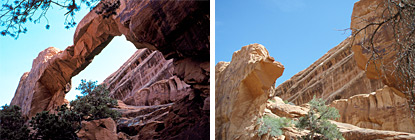
Strange Maps features federally-owned lands. Those of us who grew up in the west tramping those federal lands, and those of us who worked policy for those lands rarely think they should be listed as “strange” maps. Beautiful land maps, perhaps. God’s Country. It’s funny others regard it as so strange.

But we get clues. In comments at Strange Maps I noted a corporate meeting where I was chastised and ostracized for making a simple statement of fact about the ownership of lands in the west. Other than we veterans of the Sagebrush Rebellion (on all sides), ranchers, miners, and members of the Sierra Club, Wilderness Society, National Recreation and Parks Association (NRPA) [Barry Tindall? Are you still out there?], National Parks Conservation Association (NPCA), and enrolled tribal members, who pays attention to that stuff?

Too few in government pay enough attention. Fewer people outside government pay attention, especially if they don’t live in states in which the federal lands reside.

Public lands are all around us, yet we don’t see them as anything much different from any other land. Too often we don’t even see them for the resources they are. It’s as if we had a treasure of diamonds, rubies and gold, and we put it on display, and no one could see it.

For example, there was a major decision in federal district court on an issue of federalism last Friday — did you hear of it in your local newspaper, or on your local television or radio news? Nor are most people familiar with the move to amend the 1872 Mining Act, nor could most Americans describe for you what the 1872 Mining Act is or why it’s worth billions of dollars annually to the federal government, state governments, and mining corporations.

Strange Maps showed only the amount of land in federal hands in each state. Below is a map that shows where are the actual federal holdings, from the online National Atlas (nationalatlas.gov) — a map of federal lands and Indian Reservations. (A .gif preview is below; below that is a link to a .pdf file you can download.) The light green is National Forest land; the yellow is Bureau of Land Management land. The red plots are Indian reservations. Click on the map for the enlargement, you can see that Nevada, for example, has just thin threads of private lands (in white), mostly along U.S. Highway 50, and around Las Vegas.

All Federal Lands and Indian Reservations; NationalAtlas.gov, now archived at USGS

All Federal Lands and Indian Reservations; NationalAtlas.gov, now archived at USGS


Flip the pages of most geography texts, however, and you’ll find little clue of the role federal lands play in modern America, let alone the historical roles played.

History?

Sure. Notice that most of the public lands held today are in 13 western states, generally the last states allowed into the union (not exactly; Oklahoma is a 20th century admission — but it has Indian reservations; read on). Outside the 13 original colonies, which became the 13 original states, and Vermont (#14), all the land in the U.S. was held by the federal government at one time. Much of the territory between the 13 original states and the Mississippi was ceded to the U.S. by Britain in the Treaty of Paris, which ended the American Revolution. Americans thought the land useful for farming, chiefly, so the intention was to devise the lands to private holders. To that end the various Northwest Ordinances (e.g., 1785, 1786, 1787 and later) established systems to sell off the lands into private hands.

Disposal of the lands required the creation of a bureau to do the job. The General Land Office was created in 1812, and remained part of the federal government until it was folded into the new Bureau of Land Management in 1946.

That some of the lands might have national value, and should be held in federal title, did not surface as a complete idea until the Progressive Era, with the emphasis on land stewardship, under Teddy Roosevelt, Taft, and their successors. Even then, the general idea was to get most of the lands into private ownership. Roosevelt worked to preserve the most scenic and most unique lands.

Beginning with the Northwest Ordinances, the federal government set aside two sections in every township for the benefit of education. Local governments sold the tracts and put the money to school construction, or put the schools on those sections. Some of the tracts in the far western states are still there, unsold and providing no benefits to the schools. In some cases this is because the tracts are stuck inside federally-held tracts, in National Forests, in National Parks. Texas dedicated some of its state lands to provide funding for the University of Texas. Fortunately, these tracts happened to be on a pool of oil. When oil development took off, Texas’s university systems benefited (the Texas A&M System got a third of the rights along the way).

Poster advertising lands in Nebraska and Iowa

Development of the Transcontinental Railroad was financed by massive grants of land to the railroad companies. Even today the fortunes of the old Burlington Northern Railroad (now BNSF) are swelled by coal on land granted to the original companies building the rails, land the company has held for all these years. The thin line of private land across northern Nevada originally was the route of the Central Pacific Railroad — now it is approximately the route of U.S. Highway 50, “America’s Loneliest Highway.”

President Abraham Lincoln signed the Homestead Act on May 20, 1862. Under the Act, any American could lay claim to public lands for a small fee, and if he could live on the land for five years, title was vested in that citizen. This explanation comes from a lesson plan at the National Archives:

The new law established a three-fold homestead acquisition process: filing an application, improving the land, and filing for deed of title. Any U.S. citizen, or intended citizen, who had never borne arms against the U.S. Government could file an application and lay claim to 160 acres of surveyed Government land. For the next 5 years, the homesteader had to live on the land and improve it by building a 12-by-14 dwelling and growing crops. After 5 years, the homesteader could file for his patent (or deed of title) by submitting proof of residency and the required improvements to a local land office.

When I was a child in southern Idaho, customers at my parents’ furniture store included many people who were still trying to make a go of things on homesteads north of Burley, Idaho, on “the North Side.” Much of the land granted this way could not support a family, and the failure rate of these homesteads in the 1950s and 1960s was probably more than 50 percent (I’m swagging the figure — if you have better statistics, send them along).

Overall, the Homestead Act shaped America’s character as a home for entrepreneurs:

By 1934, over 1.6 million homestead applications were processed and more than 270 million acres—10 percent of all U.S. lands—passed into the hands of individuals. The passage of the Federal Land Policy and Management Act of 1976 repealed the Homestead Act in the 48 contiguous states, but it did grant a ten-year extension on claims in Alaska.

Much of the land that open for homesteading was desert, unsuitable for farming. It was available for grazing cows and sheep, though, and much of it was overgrazed. (Grazing alone wouldn’t meet the homestead requirements.) It was not until the 1970s that people outnumbered sheep in Utah, for example. In the first three decades of the 20th century enormous flocks of sheep grazed much of what is now considered Utah’s western desert territory, flocks of thousands of sheep, or tens of thousands.

These lands, too arid for farming, too hilly for much of anything else, too far away from settlements for other commerce, eventually formed the core of lands held by the Bureau of Land Management (BLM) in the Department of Interior. BLM manages 264 million acres of land, far and away the biggest land management agency in the federal government. Much of the land was severely overgrazed by 1930, and after the harsh lessons of the Dustbowl, Congress tried to rope in grazing and set it up in a rational scheme in the Taylor Grazing Act of 1934, one of the lesser noted chunks of the New Deal era.

The major federal land management agencies today include the Department of Interior’s BLM, National Park Service, Fish and Wildlife Service, Bureau of Reclamation, and to a lesser and more complicated degree, the Bureau of Indian Affairs; the Department of Agriculture’s National Forest Service; and the Department of Defense, especially in the western public lands states (think Nevada gunnery range, Skull Valley and Dugway Proving Grounds, Utah, and Area 51).

Each area of land management policy is controversial to some degree, but even these controversies rarely rise to the level of public acknowledgment. The latest starlet’s sexcapades will grab headlines away from the major effort to overhaul mining law, for example. In the 1980s, Alaska voted on a proposal to secede from the union, but the issue barely got three paragraphs in the Washington Post or New York Times, two of the newspapers that are generally very good in covering such issues. This post barely scratches the surface of these issues.

(Digression: I first encountered Molly Ivins when she reported for the NY Times out of the Denver bureau; as a Scout I had hiked and traveled much of Utah and the west; as a Senate staffer to a western senator, I was intimately familiar with most of the land in Utah especially. Ivins wrote a story on a protection issue on a chunk of land and a formation I’d not been familiar with, and in sparring with her about the article, it became very clear that she had pulled out sources we didn’t know about, and that she knew the stuff about as well as we did. Anyone who bothers to give a damn about western lands can earn my respect with such careful research.)

As a side note, Strange Maps suggested that the District of Columbia was all federal lands, but most of the District has been devised into private property, and commenters noted that. Here is a map of the District showing its federally-maintained lands.

District of Columbia and Federal Lands; NationalAtlas.gov (now at USGS)

District of Columbia and Federal Lands; NationalAtlas.gov (now at USGS)

Other resources:

Other related posts at the Bathtub:


Friends of Rachel Carson win a quiet victory

June 13, 2008

How quiet?

None of my news readers pulled it up, either last August and September, when U.S. Rep. Jason Altmire, D-Penn., got the bill through Congress and signed into law by President Bush, nor a couple of weeks ago when the action occurred.

The Post Office in Rachel Carson’s home town, Springdale, Pennsylvania, has been named in her honor. The ceremony at the Post Office was held on May 27, 2008.

Rep. Rob Bishop’s, R-Utah, incendiary and inaccurate statement on the bill was what caught my eye originally about the continuing campaign of calumny against the author and scientist.

Rep. Altmire conducted a petition campaign in Pennsylvania, and used the lever of popular, bipartisan support to pry the bill loose from U.S. Sen. Tom Coburn’s hold in the Senate. Coburn is a Republican from Oklahoma, a physician, and an ardent advocate of spraying DDT. He had placed a hold on the bill in committee, stopping all action under the Senate’s rules of profound deference to members.

The swell of popular support made clear by Altmire’s campaign appears to have persuaded Sen. Coburn to allow the bill to move. The bill passed the Senate by unanimous consent on August 3, 2007, and got President Bush’s signature on August 9. These sorts of honorary bills generally are not targeted for political points. That Coburn allowed the bill through suggests a good deal of maturation as a senator on Coburn’s part.

Below the fold, Rep. Altmire’s press releases on the bill’s passing the Senate, and on President Bush’s signing the bill.

Photo below: Rachel Carson, birding, on a ridge (in Pennsylvania); photo originally found at site of Professor Catherine Lavender, The College of Staten Island of CUNY.

Rachel Carson, birding at Hawk Mountain Sanctuary

Rachel Carson, birding at Hawk Mountain Sanctuary

Read the rest of this entry »


School of Wow

June 7, 2008

A river of real learning, a rising tide of excellence.

Art from students at the school I’d like to attend many days:

Art on the beach, The Living Classroom

Wouldn’t you like to do what those students at the Community School of West Seattle do?

See also Andy Goldsworthy.


Strange Maps lets things drift – ducky!

May 21, 2008

Strange Maps jumped onto the duck bandwagon I mentioned some weeks ago. Nice maps of the drift of the rubber ducks that fell off the ship in the Pacific in 1992.

These ducks have been tracked for longer than some of our geography students have been alive. There’s got to be in that story somewhere a great set of lesson plans on ocean currents, oceanography, geography and science.

Pamela Bumsted gave us the goods on this story long ago:

“Wired Science” on PBS has video, and links to other materials (see the slide show), covering all sorts of flotsam tracking projects (Nike’s shoes seem to be better floaters than the ducks — doesn’t that threaten some old adages about ducks and water?). And this video introduces the serious issues of lost and discarded plastics drifting in the oceans. Floating plastic is a major polluter, not just an eyesore, but also a major hazard to marine wildlife, including especially turtles and birds. (There are projects in that topic, I’m sure.)

Vodpod videos no longer available. from www.pbs.org posted with vodpod

The deniers of global warming will be unhappy to see the accuracy with which the ocean currents were predicted, 15 years ago.

29,000 ducks went overboard; only about 1,000 have been found since. Lots of research to be done on beaches out there — fortunately, summer’s coming (hint, hint).

Other resources, courtesy of Wired Science’s site:

Other resources:


The Wrong Stuff, on purpose: Weikart misquotes Darwin

May 10, 2008

Richard Weikart is an arm of the Discovery Institute’s disinformation brigade. A couple of years ago he published a book attempting to link Darwin to the Holocaust in a blame-sharing arrangement. This book and some of its arguments appear to be the foundation of the text used to write the script for the mockumentary movie “Expelled!” featuring Nixon speechwriter Ben Stein.

Which is to say, the basis for the movie is dubious. Weikart’s scholarship creating links between Darwin, science and Hitler is quite creative. It is also based on arguments created from Darwin’s writings that mislead the innocent about evolution, science and history, or which get Darwin and evolution exactly wrong.

Michael Ruse published an op-ed in a Florida paper in February — a piece which is no longer available there (anybody got a copy? Nebraska Citizens for Science preserved a copy) — and Weikart responded, restating his creative claims. Alas for the truth, Weikart’s canards are still available at the Discovery Institute website, putting an interesting twist on Twain’s old line: The truth will go to bed at night while a falsehood will travel twice around the world as the truth kicks off its slippers.

Looking for Ruse’s piece, I found Weikart’s response here and here. I composed a quick response pointing out the problems, which I would like to posit here for the record — partly because I doubt Darwiniana gets much traffic, partly because the censor-happy folks at Discovery Institute don’t allow free discussion at their site, and partly so I can control it to make sure it’s not butchered as Weikart butchers Darwin’s text.

At Darwiniana I said:

Weikart’s strip quoting of Darwin is most disappointing. [Weikart wrote:]

Darwin claimed in chapter two of The Descent of Man that there were great differences in moral disposition and intellect between the “highest races” and the “lowest savages.” Later in Descent he declared, “At some future period, not very distant as measured by centuries, the civilised races of man will almost certainly exterminate and replace throughout the world the savage races.” Racial inegalitarianism was built into Darwin’s analysis from the start.

Darwin argued the differences in intellect and manners between the “highest” of men and the “lowest” of men did NOT change the fact that we are are all related — legally, Darwin’s argument would evidence a claim absolutely the opposite of what Weikart claims. Here are Darwin’s words from Chapter II of Descent of Man, as Darwin wrote them, without Weikart’s creative editing:

Nor is the difference slight in moral disposition between a barbarian, such as the man described by the old navigator Byron, who dashed his child on the rocks for dropping a basket of sea-urchins, and a Howard or Clarkson; and in intellect, between a savage who uses hardly any abstract terms, and a Newton or Shakespeare. Differences of this kind between the highest men of the highest races and the lowest savages, are connected by the finest gradations. Therefore it is possible that they might pass and be developed into each other. [emphasis added]

That’s not inegalitarianism at all — Darwin’s saying they are the same species, related closer than the poets allow. If we stick to the evidence, and [do] not wander off into poetic philosophy, we must acknowledge that Darwin’s own egalitarian spirit shows here in the science, too. It would be an odd kettle of fish indeed that a crabby guy like Hitler, who shared the antiscience bias of Weikart’s organization, would suddenly accept the science of a hated Englishman that ran contrary to his other philosophies. Who makes the error here, Hitler or Weikart? If they both think Darwin endorsed racism, they both do — but there is not an iota of evidence that Hitler based his patent racism on science, let alone the science of an Englishman.

As to the second quote, Weikart leaves the context out, and the context is everything. Darwin is not arguing that “savages” (the 19th century word for “aboriginals”) were less human, nor that they are a different species. He was arguing that in some future time there would appear creationists like Dr. Weikart’s colleagues at the Discovery Institute who will deny evolution because, once Europeans and others with guns conduct an unholy genocide (which Darwin writes against in the next chapter), and once humans wipe out chimpanzees, orangs and gorillas, the other great apes, the creationists can [then] dishonestly look around, blink their eyes and say, “Where are the links? There cannot be evolution between (Animal X) and humans!”

Darwin wrote:

At some future period, not very distant as measured by centuries, the civilised races of man will almost certainly exterminate, and replace, the savage races throughout the world. At the same time the anthropomorphous apes, as Professor Schaaffhausen has remarked (18. ‘Anthropological Review,’ April 1867, p. 236.), will no doubt be exterminated. The break between man and his nearest allies will then be wider, for it will intervene between man in a more civilised state, as we may hope, even than the Caucasian, [emphasis added] and some ape as low as a baboon, instead of as now between the negro or Australian and the gorilla.

In the end, Darwin wrote against genocide, against racism, and in favor of the higher thinking abilities of all dark-skinned people. He wrote in favor of Christian morality. Darwin himself remained a faithful, tithing Christian to the end of his life.

Such a man, and such amazing science, deserve accurate history, not the fantastic, cowardly and scurrilous inventions Dr. Weikart has given them. We should rise to be “man in a more civilized state” as Darwin had hoped.

Update, July 24, 2008, nota bene:  To anyone venturing here from the Blogcatalog discussion on intelligent design: Get over to the site of Donald Johanson’s Institute for Human Origins, and especially look at the presentation “On Becoming Human.”  Also check out the Evolution Gateway site at Berkeley, especially this page which explains what evolution is, and this page which offers some introduction for what the evidence for evolution really is.  One quick answer to a question someone asked there:  Between H. erectus and modern humans, H. sapiens, in the time sequence we have fossils of H. heidelbergensis and H. neanderthalensis.  It’s pretty clear that Neandertal is not ancestral to modern humans, but instead lived alongside modern humans for 50,000 years or so from the Middle East through Southern Europe.  To the question of actual transitional fossils, you’d need to hit the paleontology journals — there are a lot.  You may also benefit from taking a look at the articles at this special Nature site.


Archaeology marches on! Carnivals to catch up

May 7, 2008

Testing, grading, trying to correct errors, and meanwhile progress continues.

Four Stone Hearth’s 40th edition is out today at the redoubtable Remote Central — but I missed #39 at Hominin Dental Anthro.

Real science is almost so much more interesting than faux science. #39 features the discussions about the claims that the Hobbits had dental fillings. While such a claim is damaging either to the claims of the age of Homo floresiensis or to the claims about the age of the specimens and, perhaps, human evolution, no creationist has yet showed his head in the discussion. When real science needs doing, creationists prefer to go to the movies. There is even a serious discussion of culture, and what it means to leadership of certain human tribes, with nary a creationist in sight.

While you’re there, take a careful look at the header and general design of Hominin Dental Anthro. Very pretty layout, don’t you think?

#40 at Remote Central is every bit as good. World history and European history teachers will want to pay attention to the posts on extinctions on the islands of the Mediterranean. Any one of the posts probably has more science in it in ten minutes’ reading than all of Ben Stein’s mockumentary movie, “Expelled!” That’s true especially when science is used to skewer the claims of the movie, or when discussion turns to the real problems the mockumentary ignores.

Enjoy the cotton candy.


Geologist finds meteor crater – on Google Earth

April 11, 2008

Geologist Arthur Hickman used Google Earth to look at part of Australia he was studying. In the satellite photos provided by Google Earth, Hickman noticed something no one else had seen: An impact crater.

Hickman Crater, Australia

For his alertness, Hickman had the 270-meter crater named after him.