Colorado officially joined the Union on August 1, 1876.
Coloradans should fly U.S. flags today in honor of statehood. Colorado was the 38th state admitted to the union.
Colorado officially joined the Union on August 1, 1876.
Coloradans should fly U.S. flags today in honor of statehood. Colorado was the 38th state admitted to the union.
 3 Comments |
  Flag etiquette, Fly your flag today, History, Statehood | Tagged: Colorado, Flag etiquette, Fly your flag today, History |
  Permalink
 Posted by Ed Darrell
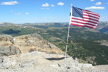
U.S. flag on American Flag Mountain, near Taylor Park, Colorado. Photo from Hobo Jeepers.
August 1 is Colorado’s statehood day. Unlike many other states, Colorado actually celebrates the day.
More accurately, people of Colorado celebrate the day. It seems most Colorado residents are happy to be there, and take any excuse to celebrate their good fortune.
#ColoradoDay even trended on Twitter for time today.
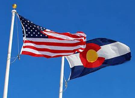
Under the provisions of the U.S. Flag Code, residents of a state are invited to fly the U.S. flag on their state’s day of statehood. Colorado came into the Union on August 1, at the declaration of President U. S. Grant, in 1876. People of Colorado tend to favor Colorado’s flag for most displays, on Colorado Day.
How are others celebrating? Free admission to Colorado State Parks, for one.
https://twitter.com/CaseyJPorter/status/892488499911426049
https://twitter.com/VegucationMama/status/892485902995304448
https://twitter.com/dwphotosco/status/892483447649779712
https://twitter.com/elieze_garner/status/892477389015527428
https://twitter.com/BriandaQuinones/status/892473969760141312
https://twitter.com/railfan4christ/status/892472012655927296
Well, yes, every other state has a statehood day, but don’t look for this effusive outpouring of state pride for many others, including Texas.
https://twitter.com/Jimbofoxman/status/892467827269140481
https://twitter.com/walkershow/status/892467003415552005
Leave a Comment » | Fly your flag today, History, Statehood | Tagged: Colorado, Fly your flag today, History, Statehood | Permalink
Posted by Ed Darrell
Colorado won proclamation as a state on August 1, 1876, the 38th state in the United States.
August 1 is Colorado Statehood day. U.S. Flag Code urges residents to fly the U.S. flag on the day their state entered the union — today, for Colorado. They call it Colorado Day now.
U.S. and Colorado flags flutter from the same flagpole. Denver Library image
According to Colorado newspaperman and politician Jerry Koppel, Colorado’s path to statehood started in 1864, in an attempt to get another Republican state to boost Abraham Lincoln’s re-election chances. Coloradans rejected the proposed constitution in a plebiscite, however, which pushed the effort into the next Lincoln administration — which, sadly, a month into Lincoln’s new term, became the Andrew Johnson administration.
High politics: Colorado took a tortuous path to statehood. While Colorado was not frustrated so often nor so long as it’s nextdoor neighbor, Utah, laws proposed to bring the state into the union were vetoed twice by President Andrew Johnson. History from the Andrew Johnson National Historical Site in Greenville, Tennessee:
Colorado Statehood
First Veto:
1. There was such a small population in the area, Johnson felt Colorado would fare better as a territory without the added taxation of statehood.
2. Also due to the small population, Colorado would have only one representative to speak for the people in Congress. (New York, on the other hand, had thirty-one).
3. Johnson felt the citizens of Colorado were not prepared for, and not all wanted, statehood. Johnson wanted to hold a census or an election there first. This would ascertain the number of people in the area, as well as find out what their strongest desire was.
Second veto:
1. Johnson didn’t agree with the Edmunds Amendment which said that Nebraska and Colorado had to give equal suffrage to blacks and whites as a statehood condition. Johnson felt this was unconstitutional because Congress couldn’t regulate a state’s franchise, and the people had not been allowed to vote on it.
2. After holding a census, Johnson felt the population was still too small for statehood.
NOTE: In addition, Johnson did not feel right about adding new states to the Union when the Confederate States had not yet been readmitted to the Union and were still unrepresented.
Congress sustained the veto.

Jerome B. Chaffee, one of Colorado’s first U.S. Senators, and the man who earlier pushed through Congress the law admitting Colorado into the Union. Library of Congress description: “Chaffee, Hon. J.B. of Colorado” (Photo credit: Wikipedia)
Colorado Republican and millionaire Jerome Chaffee, serving as the Colorado Territory delegate to Congress, managed to get a statehood bill passed in 1875, in the second term of President Ulysses S Grant; Grant signed the law. Colorado drafted a state constitution that passed muster, Coloradans approved it, and President Grant declared Colorado the 38th state on August 1, 1876. Chaffee was elected one of the first U.S. Senators from Colorado by the new state legislature. In an odd footnote, President Grant’s son, Ulysses S Grant, Jr., married Chaffee’s daughter Fannie in 1881.
In 1875, Chaffee claimed 150,000 people lived in the state, but most historians think that figure was inflated; the 1880 census counted 194,000 people. Some historians doubt that count was accurate.
No doubt there are at least that many people in Colorado today. Several counties in the northeast corner of the state got together in 2013 to explore the possibility of separating from Colorado to form their own state. Does the political cauldron in Colorado ever cool? (Did those secessionists ever cool?)
Happy statehood day, to the Centennial State.
More:

One of the more dramatic images from Colorado in recent years, courtesy the U.S. Air Force. Captioned in the Las Vegas Review-Journal, June 15, 2013: “An American flag hangs in front of a burning structure in the Black Forest, a thickly wooded rural region north of Colorado Springs, Colo. Authorities reported early Saturday that 473 houses had been incinerated.” Wildfires plagued Colorado 2012-2015, a function of effects of a warming climate.
DoD photo by Master Sgt. Christopher DeWitt, U.S. Air Force

PRCA Rodeo in Steamboat Springs, Colorado; photo from SeaSweetie’s Pages

5 Comments | Flag etiquette, Fly your flag today, History, Statehood | Tagged: Colorado, Flag etiquette, Fly your flag today, History, Statehood | Permalink
Posted by Ed Darrell
Our friends who steward our public lands find great beauty in America; this is what they protect, and why they protect it.

Caption from U.S. Department of Interior on Twitter: #Sunrise over the snowy mountains @rockynps is amazing. Photo by Eric Schuette #Colorado
Leave a Comment » | America the Beautiful, photography, Public Lands | Tagged: America the Beautiful, Colorado, Eric Shuette, photography, Public Lands | Permalink
Posted by Ed Darrell
Colorado won proclamation as a state on August 1, 1876, the 38th state in the United States.

U.S. and Colorado flags flutter from the same flagpole. Denver Library image
According to Colorado newspaperman and politician Jerry Koppel, Colorado’s path to statehood started in 1864, in an attempt to get another Republican state to boost Abraham Lincoln’s re-election chances. Coloradans rejected the proposed constitution in a plebiscite, however, which pushed the effort into the next Lincoln administration — which, sadly, a month into Lincoln’s new term, became the Andrew Johnson administration.
High politics: Colorado took a tortuous path to statehood. While Colorado was not frustrated so often nor so long as it’s nextdoor neighbor, Utah, laws proposed to bring the state into the union were vetoed twice by President Andrew Johnson. History from the Andrew Johnson National Historical Site in Greenville, Tennessee:
Colorado Statehood
First Veto:
1. There was such a small population in the area, Johnson felt Colorado would fare better as a territory without the added taxation of statehood.
2. Also due to the small population, Colorado would have only one representative to speak for the people in Congress. (New York, on the other hand, had thirty-one).
3. Johnson felt the citizens of Colorado were not prepared for, and not all wanted, statehood. Johnson wanted to hold a census or an election there first. This would ascertain the number of people in the area, as well as find out what their strongest desire was.
Second veto:
1. Johnson didn’t agree with the Edmunds Amendment which said that Nebraska and Colorado had to give equal suffrage to blacks and whites as a statehood condition. Johnson felt this was unconstitutional because Congress couldn’t regulate a state’s franchise, and the people had not been allowed to vote on it.
2. After holding a census, Johnson felt the population was still too small for statehood.
NOTE: In addition, Johnson did not feel right about adding new states to the Union when the Confederate States had not yet been readmitted to the Union and were still unrepresented.
Congress sustained the veto.
Jerome B. Chaffee, one of Colorado’s first U.S. Senators, and the man who earlier pushed through Congress the law admitting Colorado into the Union. Library of Congress description: “Chaffee, Hon. J.B. of Colorado” (Photo credit: Wikipedia)
Colorado Republican and millionaire Jerome Chaffee, serving as the Colorado Territory delegate to Congress, managed to get a statehood bill passed in 1875, in the second term of President Ulysses S Grant; Grant signed the law. Colorado drafted a state constitution that passed muster, Coloradans approved it, and President Grant declared Colorado the 38th state on August 1, 1876. Chaffee was elected one of the first U.S. Senators from Colorado by the new state legislature. In an odd footnote, President Grant’s son, Ulysses S Grant, Jr., married Chaffee’s daughter Fannie in 1881.
In 1875, Chaffee claimed 150,000 people lived in the state, but most historians think that figure was inflated; the 1880 census counted 194,000 people. Some historians doubt that count was accurate.
No doubt there are at least that many people in Colorado today. Several counties in the northeast corner of the state got together in 2013 to explore the possibility of separating from Colorado to form their own state. Does the political cauldron in Colorado ever cool? (Did those secessionists ever cool?)
Happy statehood day, to the Centennial State.
More:

One of the more dramatic images from Colorado in recent years, courtesy the U.S. Air Force. Captioned in the Las Vegas Review-Journal, June 15, 2013: “An American flag hangs in front of a burning structure in the Black Forest, a thickly wooded rural region north of Colorado Springs, Colo. Authorities reported early Saturday that 473 houses had been incinerated.”
PRCA Rodeo in Steamboat Springs, Colorado; photo from SeaSweetie’s Pages

Yes, this is mostly an encore post. Fighting ignorance requires patience.
Leave a Comment » | Flag etiquette, Fly your flag today, History, Statehood | Tagged: Colorado, Flag etiquette, Fly your flag today, History, Statehood | Permalink
Posted by Ed Darrell
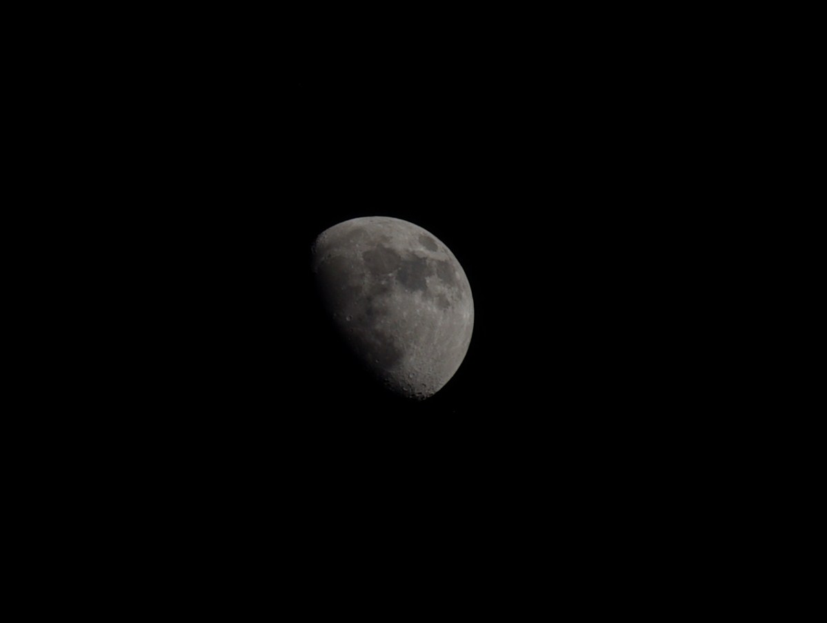
Dallas Moon, June 7, 2014; sure it’s copyrighted, but please use it with abandon.
I got a pretty good shot at the Moon back in June, considering it’s just a 200 mm telephoto, and I was shooting handheld, without the tripod. You can’t tell from the picture, but the sky was blue. One of the issues of getting a good Moon shot concerns exposure — and this time, I got the Moon right. Sky is black, but there you go. We were walking the dog.
I’ve made a lot of photographic experiments over the summer, none of which I’ve posted. I’m also fighting computer issues with both the laptop and desktop, and downloads have been uncertain. The shot above, for example, shows up in some indices, but not in others. Can’t post it if I can’t tell WordPress what to upload, you know? Who really understands computer logic?
I’ve made two trips to Colorado to visit James and Michelle. None of the photos are up yet — and there are, actually, thousands. None of the thought rambles are up, either. I got ambushed by a fellow with “the easiest political quiz in the world” while drinking beer and listening to the Bodeans in Louisville, Colorado; there’s a photo somewhere of my pointing out the errors of the guy’s quiz, and his confessions that he’s a libertarian in GOP clothing; and then there were our visits to those temples to the failures of libertarianism, including the Florissant Fossil Beds National Monument, and the Black Canyon of the Gunnison National Park and Mesa Verde N.P. Colorado libertarians live among the disasters and ruins of libertarian thought, but think and claim they are held back by the ropes their rescuers throw to them.
I hope I’ve got the streams of posts flowing again, Dear Reader. Your past patience is greatly appreciated.
Leave a Comment » | Administrivia, Liberty, photography, Weblogs | Tagged: Administrivia, blogging, Colorado, Libertarianism, photography | Permalink
Posted by Ed Darrell

From Susan Ohanian’s NCLB Cartoons: “Every year, the Coalitition for Better Education raises grassroots funds to put up these billboards. You can contribute. You can go forth and do likewise in your state.”
Dr. Diane Ravitch, former Assistant Secretary of Education for Research, said at her blog:
The corporate types who hate teachers’ unions and public schools have been running a billboard and mass media campaign in New York and New Jersey.
But they are not the only ones who know how to frame a message.
Here is a fabulous billboard posted on a major highway in Colorado by critics of the nutty testing regime imposed by No Child Left Behind and Race to the Top.
Leave a Comment » | Education, Education assessment, No Child Left Behind Act, Testing | Tagged: Colorado, Education, NCLB, No Child Left Behind, Testing | Permalink
Posted by Ed Darrell
Looks like snow to me. From the Department of Interior:

Fall colors have arrived at the Great Sand Dunes National Park. #nature #autumn #colorado pic.twitter.com/34RXSkuBLe
1 Comment | Geography - Physical, Landmarks, National Parks, Travel | Tagged: Colorado, Department of Interior, geography, Great Sand Dunes NP, Land Forms, photography, Travel | Permalink
Posted by Ed Darrell

Painting of the Sand Creek Massacre, Colorado Historical Society
Sometimes the e-mail I get brings wind of real history discussions, and this one sounds interesting even if the Texas State Board of Education is trying to run away from U.S. history on the issues of war on Native Americans.
Teachers, you can get an hour of CE credit, if you phone and let them know in advance.
And it’s free.
These sessions are good, and if you think you don’t know enough to ask good questions, you should understand that SMU faculty will be there to grill the author if you don’t.
A Misplaced Massacre:
Struggling over the Memory of Sand Creek
Ari Kelman, University of California-DavisThursday, September 19, 2013
6 pm reception followed by 6:30 lecture and book-signing
The DeGolyer Library
6404 Hilltop Lane at McFarlin Boulevard, on the campus of SMUIn this lecture, Kelman will examine the ways in which generations of Americans have struggled to come to terms with the meaning the Sand Creek Massacre and its aftermath, most publicly at the 2007 opening of the Sand Creek Massacre National Historic Site in Kiowa County, Colorado.
Books will be available for purchase and for signing.
Although this event is free and open to the public, seating is limited. Please register on the link below. If you have questions or need special accommodations, please call 214-768-3684 or email swcenter@smu.edu
More:
Leave a Comment » | History, Native Americans | Tagged: Colorado, History, Indian Wars, Native American, Sand Creek Massacre, Southern Methodist University | Permalink
Posted by Ed Darrell
August 1 is the anniversary of the day in 1876 when Colorado was proclaimed a member of the union, the 38th state in the United States.
U.S. and Colorado flags flutter from the same flagpole. Denver Library image
According to Colorado newspaperman and politician Jerry Koppel, Colorado’s path to statehood started in 1864, in an attempt to get another Republican state to boost Abraham Lincoln’s re-election chances. Coloradans rejected the proposed constitution in a plebiscite, however, which pushed the effort into the next Lincoln administration — which, sadly, a month into Lincoln’s new term, became the Andrew Johnson administration.
High politics: Colorado’s path to statehood was not straight. While Colorado was not frustrated so often nor so long as Utah, proposed laws to bring the state into the union were vetoed twice by President Andrew Johnson. History from the Andrew Johnson National Historical Site in Greenville, Tennessee:
Colorado Statehood
First Veto:
1. There was such a small population in the area, Johnson felt Colorado would fare better as a territory without the added taxation of statehood.
2. Also due to the small population, Colorado would have only one representative to speak for the people in Congress. (New York, on the other hand, had thirty-one).
3. Johnson felt the citizens of Colorado were not prepared for, and not all wanted, statehood. Johnson wanted to hold a census or an election there first. This would ascertain the number of people in the area, as well as find out what their strongest desire was.
Second veto:
1. Johnson didn’t agree with the Edmunds Amendment which said that Nebraska and Colorado had to give equal suffrage to blacks and whites as a statehood condition. Johnson felt this was unconstitutional because Congress couldn’t regulate a state’s franchise, and the people had not been allowed to vote on it.
2. After holding a census, Johnson felt the population was still too small for statehood.
NOTE: In addition, Johnson did not feel right about adding new states to the Union when the Confederate States had not yet been readmitted to the Union and were still unrepresented.
Congress sustained the veto.
Jerome B. Chaffee, one of Colorado’s first U.S. Senators, and the man who earlier pushed through Congress the law admitting Colorado into the Union. Library of Congress description: “Chaffee, Hon. J.B. of Colorado” (Photo credit: Wikipedia)
Colorado Republican and millionaire Jerome Chaffee, serving as the Colorado Territory delegate to Congress, managed to get a statehood bill passed in 1875, in the second term of President Ulysses S Grant; Grant signed the law. Colorado drafted a state constitution that passed muster, Coloradans approved it, and President Grant declared Colorado the 38th state on July 1, 1876. Chaffee was elected one of the first U.S. Senators from Colorado by the new state legislature. In an odd footnote, President Grant’s son, Ulysses S Grant, Jr., married Chaffee’s daughter Fannie in 1881. In 1875, Chaffee claimed 150,000 people lived in the state, but most historians think that figure was inflated; the 1880 census counted 194,000 people, but some historians doubt that count was accurate.
No doubt there are at least that many people in Colorado today. Several counties in the northeast corner of the state recently got together to explore the possibility of separating from Colorado to form their own state. Does the political cauldron in Colorado ever cool?
More:
One of the more dramatic images from Colorado in recent years, courtesy the U.S. Air Force. Captioned in the Las Vegas Review-Journal, June 15, 2013: An American flag hangs in front of a burning structure in the Black Forest, a thickly wooded rural region north of Colorado Springs, Colo. Authorities reported early Saturday that 473 houses had been incinerated.
PRCA Rodeo in Steamboat Springs, Colorado; photo from SeaSweetie’s Pages
10 Comments | Flag etiquette, Fly your flag today, History, Statehood | Tagged: Colorado, Flag etiquette, Fly your flag today, History, Statehood | Permalink
Posted by Ed Darrell
Here’s one of my nominees for the next editions of Great Speeches of the 21st Century, and Great Speeches in American History. Sen. Mike Johnston, on March 11, in the Colorado State Senate, spoke against coward, “hollow men,” who commit mass shootings, and how to protect from them:
Notes from YouTube posting:
Published on Mar 12, 2013
March 11, 2013: Sen. Mike Johnston (D-Denver) describes how gun safety legislation, particularly HB 13-1224, can make a difference.
What do you think?

Colorado State Senator Michael Johnston – Wikipedia Photo
‘Eleven kids saved in eleven seconds’ seems like a powerful argument, to me.
And this: “And so the bad news is that at that moment will be outgunned. The good news is that in America that never means we will be outfought.”
And this: “The task of taking lives, and the task of saving lives, are fundamentally different endeavors, and they require different tools.”
At about 6:04 into this, listen to Sen. Johnston talk about the “cost of living and loving is that it takes up so much space in our lives.”
Wow.
More:
2 Comments | Great Speeches, Law, Legislation, Legislatures, Second Amendment | Tagged: Colorado, Colorado Senate, Great Speeches, Gun Control, HB 13-1224, Law, Legislation, Legislatures, Newtown, School Safety, Second Amendment, Sen. Mike Johnston, Violence | Permalink
Posted by Ed Darrell
Take a look at this sunset shot:

Sunset on BLM land near the Little Snake River, in northwest Colorado. Photo by Shannon Diszmang, via Royal Gorge National Recreation Area.
Note from America’s Great Outdoors blog:
Earlier this year, the Royal Gorge Recreation Area staff had a photo contest on their Facebook page and here is one of the great photos that was submitted. Here’s what photographer, Shannon Diszmang, had to say about it.
“This is BLM land in Northwest Colorado (Little Snake River district). I fell in love with this place. The red haze in this photo is the smoke coming from the wildfires on the west coast at the time. This is one of the lowest light pollution spots in our state which makes star gazing the absolute best.”
So, if you’re nearby, and you want a good place to look at the Geminid meteor shower tonight, odds are high there will be little light pollution here. If there aren’t many clouds, you’re in luck.
More:
P.S.: The stunningly beautiful photo above is NOT the winner of the photo contest(!). BLM wrote in a November press release:
CAÑON CITY, Colo. – Today the BLM Royal Gorge Field Office announced the winners of its BLM-sponsored photo contest. The two winners were decided by the public via the RGFO’s Facebook page: one winner is based on the most “likes” and the other is based on the most “shares.” Only those “likes” and “shares” that originated from the Royal Gorge Facebook page were tallied towards a winner.
Chris Nelson’s photo was the most “liked” and is a scenic shot taken from Chaffee County Road 175 between Cañon City and Salida. Nelson’s photo received 64 “likes.”
The most “shared” photo was submitted by David Madone and portrayed several deer in an alfalfa field near Cañon City. Madone’s photo received 20 shares.
Both photos will be featured on the RGFO’s Facebook page throughout November and may be featured in future BLM Colorado publications and social media sites.
The photo contest began Oct. 2 and ended Nov. 4 with more than 60 photos submitted. All the photos that were entered into the contest may be viewed via the “Photo Contest” album on the RGFO’s Facebook page: http://www.facebook.com/BLMRoyalGorge
Yeah, were I you, I’d go see what the winners looked like.
4 Comments | Astronomy, Bureau of Land Management (BLM), Geography - Physical, Outdoor Recreation, photography, Public Lands, Travel | Tagged: Astronomy, BLM, Bureau of Land Management, Colorado, geography, Outdoor Recreation, photography, Travel | Permalink
Posted by Ed Darrell
White-breasted nuthatch (Sitta carolinensis) (male?), cracking a nut on a pine limb, Peaceful Valley Scout Ranch, Colorado, July 2012:

White-breasted nuthatch (Sitta carolinensis)works over a seed, Colorado, 2012 – photo by Ed Darrell
2 Comments | Bird Watching, Nature, Ornithology, Science, Travel | Tagged: Bird Watching, Colorado, Nature, Ornithology, Science, Travel, White-breasted Nuthatch | Permalink
Posted by Ed Darrell
. . . for the rainbow.
A view from Elbert Road, a few miles north of U.S. Highway 24 in Colorado, on July 18, 2012:
")
Start of a dual rainbow in an afternoon rainfall, Elbert Road, Colorado – photo by Ed Darrell
Leave a Comment » | photography, Physics, Science, Travel | Tagged: Colorado, photography, Physics, Science, Travel | Permalink
Posted by Ed Darrell
This is a story of two cities located within 100 miles of each other in Colorado, in that paradise created by close mountain recreation, clean and clear western vistas, and local, great universities. The question is, does this story tell a tale of urban growth that mistakenly shows up as global warming, or is it a story of wise planning that avoids the harms of global warming — or something else in between, or completely different?

Boulder, Colorado at twilight, at the foot of the Rockies – Wikipedia Image by Phil Armitage
Anthony Watts complained that I don’t read his blog closely enough, or often enough. He may rue the day he made that complaint.
Browsing over there I found a post hidden under a headline, “A UHI Tale of Two Cities.” I say “hidden” because Watts once again falls victim to the Dunning-Kruger syndrome of using an acronym, UHI, which sounds sciency but is in fact confusing to anyone not following the debate closely. I’m science literate, I’ve done research, I’ve done air pollution research, I’ve served state, federal and local governmental bodies working on environmental issues, and “UHI” didn’t ring any bells with me. It’s a MEGO phrase, in other words: My Eyes Glaze Over.
It took five clicks, but I discovered UHI is “urban heat island,” the well-worried-over effect of cities, with all their concrete, asphalt and steel, holding heat longer than surrounding countryside. In some cases, it is hypothesized that these urban heat islands affect or create their own weather. In the airline industry we worried about late afternoon thunderstorms that continued well past historical evening limits (and I suspect airline meteorologists and flight schedulers still worry about the issue, but I’ve been out of it for well over a decade).
For the study of global warming, the issues are simple but important: Do temperature measures made in or near big cities inaccurately show warming that is wholly local, and mislead scientists into thinking there is global warming? Or is some of the supposed heat island effect instead due to global warming? And, if it the urban heat island effect is mostly local, should we worry about it when developing policies to combat global warming and preserve our forests, wildlands and wildlife, wildernesses. oceans, rivers, farmlands and urban areas, and modern life?

Southwest quadrant of Boulder Colorado, showing greenbelt and trails – image from city website with information on greenbelt use and open space regulations, and maps. Boulder’s greenbelt open space and wild lands may get more visitors than nearby Rocky Mountain National Park.
In the post at Watts’s site, this is stated (from Watts? from someone else? Who can tell?):
Conclusion:
We have two weather stations in similarly sited urban environments. Until 1965 they tracked each other very closely. Since then, Fort Collins has seen a relative increase in temperature which tracks the relative increase in population. UHI is clearly not dead.
Watts misses much of the story.
In the middle 1960s and into the early 1970s Boulder, Colorado, made conscious and careful attempts to preserve its environmental quality. In 1967 Boulder created a greenbelt plan that started the processes to preserve an open space belt around the city, to preserve wild lands and to provide a sink for air pollutants and other effects of the city. In the early 1970s the city limited city growth to assure environmental quality.
Alternatives to Growth Oregon (AGO) featured an excerpt from a book detailing several growth-controlling actions by American cities as well and succinctly as anything else I’ve found (excerpted from Better Not Bigger by Eben Fodor)
In 1967, Boulder voters approved one of the nation’s first locally funded greenbelt systems. They used a local sales tax increase of 0.4 percent to finance open space land acquisitions. As of 1998, Boulder had raised $116 million and acquired 33,000 acres of greenways and mountain parks. The greenbelt system serves as a natural growth boundary, defining the limits of the city with open space and parkland. This natural boundary helps to block urban sprawl and “leapfrog” development. The greenbelt has also helped protect the quality of life in Boulder as the city has grown. It is said that more people use the greenbelt system each year than visit nearby Rocky Mountain National Park. As an added measure, Boulder established a building height limitation of 55 feet in 1971 to preserve the view of the Rockies. The city and surrounding county have cooperated on planning and growth-management policies and jointly adopted the Boulder Valley Comprehensive Plan. A city-county study in 1970 showed the area’s population doubling in 20 years to 140,000. This projection alarmed many residents and prompted discussions about optimum population size. A public opinion survey found that more than 70 percent of respondents favored population stabilization near the 100,000 level.
In November, 1971 Boulder citizens set another first when they placed an initiative on the ballot to create a charter amendment setting a maximum population limit for the city. Voters narrowly defeated the initiative. The defeat may have been partly due to an alternative referendum placed on the same ballot by the city council. This second referendum was approved by 70 percent of voters and directed local government to “take steps necessary to hold the rate of growth in the Boulder Valley to a level substantially below that experiences in the 1960’s.” This important decision has led to a number of experimental growth-management policies that are still being fine-tuned today.
More information on greenbelts, how they work and why they are such a great idea, can be found from the Trust for Public Lands (also here), among other sources.
Fort Collins is a college town, like Boulder, and loaded with people interested in preserving the environment. Colorado State is the state’s Land Grant College (Morrill Act), the official repository of studies of protecting and wisely using the lands of Colorado. But Fort Collins did not create a green belt. Development in Fort Collins follows rules, but rules set by more traditional zoning and protection regulations than Boulder’s green belt.

Exploring Old Town Fort Collins by bicycle – City of Fort Collins photo
Watts’s blog lays the differences in temperatures between Boulder and Fort Collins since 1965 entirely at the feet of rising population, and an assumption that rising population means more concrete, asphalt and steel (Watts writing, or someone else?). Analysis of population growth from any serious statistical viewpoint, comparing Fort Collins-Loveland SMSA against the Boulder MSA (or Denver-Boulder SMSA) is lacking. This is probably more a reminder that Watts’s blog is not engaged in serious scientific analysis global warming from a global view — nor even a national, state or regional view. The comparison is simple, on population and temperature, and probably not sustainable to the point Watts suggests he wants to take it.
The population of the City of Boulder grew less than the population of the City of Fort Collins grew. That appears to be enough for Watts.
Check with the public officials of Boulder, especially those in charge of development and zoning. They’ll let you know in a hurry that Boulder’s slower-than-Fort-Collins growth is intentional. While the Boulder plan technically has no upper limit, it slows growth so that environmental quality can be maintained, especially the greenbelt, with its manifold recreation opportunities.
Fort Collins has a lot of good recreation, too. The Cache de Poudre River offers great river running within 40 minutes of downtown in the summer, and the local National Forests and other public lands offer camping, hiking, hunting, fishing, and I imagine, snowmobiling in winter. There are bike paths through Fort Collins — but not the green, automobile-free style of trails available all around Boulder.

Scouts climbing at Camp Ben DelaTour, outside of Fort Collins – Longs Peak Council BSA photo
Perhaps most important, Fort Collins experiences “leapfrog” development that Boulder specifically spurned 40 years ago. New businesses cluster along roads into town, frequently just out of the city limits and beyond the zoning rules of the city, at least until the city annexes the land and its problems. This is the traditional growth model for American cities. What it ensures is urban sprawl and suburban growth. It also virtually guarantees that there will be no preserved greenlands around the city. Green land, rural or more wild, get developed in sprawl.
Here’s the question Watts and his collaborators don’t deal with: How much of Boulder’s cooler climate is due to the greenbelt, and how much due to the striving for wise development instead of sprawl? Considering Boulder’s proximity to Denver and explosive growth there, the fact that Boulder’s climate is cooler than Fort Collins’s, according to Watts, suggests even more strongly that tough protection of the environment can work wonders, if not near-miracles.
Who is Anthony Watts to claim that Boulder’s cooler climate is not the result of careful planning to preserve the environment, initiated by Boulder’s visionaries 50 years ago?
Perhaps more critically: Doesn’t Boulder demonstrate that planning that stops global warming, is feasible, practical, economical, and perhaps, preferable? Doesn’t the greenbelt, and lower temperatures, suggest that we can kill the urban heat island effect, to the betterment of local living standards?
There is a moral to the story of development in Fort Collins and Boulder, Colorado. That moral has very little, if anything, to do with heat islands. It is instead a model to tell us that planning to avoid environmental disaster is the wise thing to do. Anthony Watts has the charts to prove it.
Notes:
Update, James Madison Day (3-16-2010): Watts still doesn’t get it. In a post today he wrote:
My last few posts have described a new method for quantifying the average Urban Heat Island (UHI) warming effect as a function of population density, using thousands of pairs of temperature measuring stations within 150 km of each other. The results supported previous work which had shown that UHI warming increases logarithmically with population, with the greatest rate of warming occurring at the lowest population densities as population density increases.
Comparing Fort Collins with Boulder, and noting that Fort Collins grew faster, is an inadequate explanation for more warming in Fort Collins, about 40 miles north of Boulder. Boulder has a greenbelt designed to frustrate global warming, locally and globally. To fail to account for the effect of a massive green belt of 33,000 acres — more than double the size of the city’s 16,000 acres — is a failure of science. If Watts’s methodology misses such factors that slap an unbiased viewer in the face, you’ve gotta wonder what else he’s missing. If he can’t see a greenbelt twice the size of the city, surrounding the city, what else has he overlooked?
Plus there is this: Assume for a moment that he proves a heat island effect exists (a proposal unquestioned in meteorology and atmospheric sciences for a generation, by the way) — the question he’s seeking to prove is that urban heat islands skew official temperature readings enough to falsely indicate global warming. To skew measurements that include thousands of at-sea sensing devices, and rural areas around the world, there would have to be an massive effect that would be immediately obvious in the cities causing the effect: They would melt.

Flatirons rock formations, on Green Mountain, near Boulder, Colorado – Wikimedia photo by Jesse Varner


21 Comments | Clean Water Act, Climate change, climate_change, Environmental protection, Global warming, Green Politics, History, Natural history, Natural resources, Outdoor Recreation, Politics, Urbanization | Tagged: Boulder, Climate change, Colorado, Environmental protection, Fort Collins, Global warming, Green Politics, History, Politics, Research, UHI, Urban Heat Island, Urbanization | Permalink
Posted by Ed Darrell


Ed Darrell on Texas's Colorado River


Come on in, the water's fine. Come often: Cleanliness is next to godliness.