January 3, Alaska’s statehood day

January 3, 2018

Late for me to remind you, if you didn’t, but January 3 is Alaska’s Statehood Day. Alaskans should have flown their U.S. flags today in commemoration.

Of course, some people would like to fly their state flags, too — makes more sense, some say. I don’t argue, but I note that very rarely do I come across some household that has a state flag. Most homes have a U.S. flag.

Alaska’s flag is a work of art, though, and many Alaskans have one. Did you fly it today, if you have one?

More:

U.S. flag flying at the Eielson Visitor Center, Denali National Park, Alaska. National Park Service image

U.S. flag flying at the Eielson Visitor Center, Denali National Park, Alaska. National Park Service image, photo by Jacob W. Frank.


58 years ago, January 3, 1959: Welcome, Alaska, and the 49-star flag

January 3, 2017

Alaska Territorial Gov. Bob Bartlett in center, with the 49-star flag (Bartlett was one of Alaska's first U.S. senators).

Alaska Territorial Gov. Bob Bartlett in center, with the 49-star flag (Bartlett was one of Alaska’s first U.S. senators).

The great service at the New York Times site, the Learning Network, notes the 1959 Dwight Eisenhower proclamation of Alaska as the 49th state, and the unveiling of the 49-star flag:

On Jan. 3, 1959, President Dwight Eisenhower signed a proclamation admitting Alaska to the Union as the 49th state. The New York Times noted that the signing included the unveiling of the new 49-star American flag.

The land that became Alaska came into U.S. possession in 1867, when William Seward, secretary of state under President Andrew Johnson, negotiated a deal to buy the 586,000-square-mile area from Russia for $7.2 million, less than 2 cents per acre. Seward’s decision was ridiculed in the American press, who saw no potential in the vast, inhospitable and sparsely populated area.

For decades after its purchase, Alaska was derided as “Seward’s folly” or “Seward’s icebox.” This opinion changed in 1896 with the discovery of gold in the neighboring Yukon Territory, which spurred tens of thousands of people to head to Alaska in search of gold. The gold rush also brought about a boom in mining, fishing and trapping.

Though the first statehood bill had been presented to Congress in 1916, there was little desire in either Alaska or Washington for Alaskan statehood until after World War II. During the war, the U.S. established multiple military bases to resist Japan’s attacks on Alaska’s Aleutian Islands and prevent a potential invasion of the mainland. The military activity, along with the completion of a major highway from Montana, led to a large population growth.

In 1946, Alaskans voted in favor of statehood in a referendum and Alaskan delegates began to lobby Congress for statehood. After years of debate, Congress voted in June 1958 to admit Alaska.

Eight months after Alaska’s admission, on Aug. 21, 1957 [should be 1959, no?], Hawaii became the 50th state. The 49-star remained in place until the following July 4, when it was replaced by the now-familiar 50-star flag.

49-star flags were produced only until August 1959, so there are few of them around.  I love this photo of the unveiling of the flag with President Eisenhower:

President Eisenhower and Quartermaster General MG Andrew T. McNamara, with 49-star flag - image from QM foundation

“Quartermaster General MG Andrew T. McNamara and President Eisenhower examine new 49 star flag” – image and caption from the Quartermaster Foundation. Photo by Bob Schutz, Associated Press (Who are the other two people?  The guy on the right looks to me a bit like is Pennsylvania’s Sen. Hugh Scott.)

It had been about 47 years since the previous state admission (Arizona); people became aware that no law set what the flag should look like.  President Eisenhower issued a directive.

How did the nation survive for 170 years without firm, decisive and conclusive orders on what the U.S. flag should look like?  Isn’t it a great story that we went so long without law setting the requirements?

Alaska's state flag design came from 13-year old Benny Benson.

Alaska’s state flag design came from 13-year old Benny Benson. Benny Benson holding the Alaska flag at the Jesse Lee Home, Seward, Alaska. ASL-P01-1921, Alaska State Library-Historical Collections.


Alaska’s state flag came from the imagination of a 13-year-old Aleut, Benny Benson, winning a contest to design the state’s flag.  Alaska’s flag stands out in any display of U.S. state flags.

Alaska's flag as it was approved by the state legislature, and still flies today. Image from the Ninilchik Natives Association, Inc (NNAI).

Alaska’s flag as it was approved by the state legislature, and still flies today. Image from the Ninilchik Natives Association, Inc (NNAI).


Yes, this is mostly an encore post. Fighting ignorance requires patience.

Yes, this is mostly an encore post. Fighting ignorance requires patience.

Save

Save

Save

Save

Save


January 3, 1959: Welcome, Alaska, and the 49-star flag — 55 years ago

January 3, 2015

Alaska Territorial Gov. Bob Bartlett in center, with the 49-star flag (Bartlett was one of Alaska's first U.S. senators).

Alaska Territorial Gov. Bob Bartlett in center, with the 49-star flag (Bartlett was one of Alaska’s first U.S. senators).

The great service at the New York Times site, the Learning Network, notes the 1959 Dwight Eisenhower proclamation of Alaska as the 49th state, and the unveiling of the 49-star flag:

On Jan. 3, 1959, President Dwight Eisenhower signed a proclamation admitting Alaska to the Union as the 49th state. The New York Times noted that the signing included the unveiling of the new 49-star American flag.

The land that became Alaska came into U.S. possession in 1867, when William Seward, secretary of state under President Andrew Johnson, negotiated a deal to buy the 586,000-square-mile area from Russia for $7.2 million, less than 2 cents per acre. Seward’s decision was ridiculed in the American press, who saw no potential in the vast, inhospitable and sparsely populated area.

For decades after its purchase, Alaska was derided as “Seward’s folly” or “Seward’s icebox.” This opinion changed in 1896 with the discovery of gold in the neighboring Yukon Territory, which spurred tens of thousands of people to head to Alaska in search of gold. The gold rush also brought about a boom in mining, fishing and trapping.

Though the first statehood bill had been presented to Congress in 1916, there was little desire in either Alaska or Washington for Alaskan statehood until after World War II. During the war, the U.S. established multiple military bases to resist Japan’s attacks on Alaska’s Aleutian Islands and prevent a potential invasion of the mainland. The military activity, along with the completion of a major highway from Montana, led to a large population growth.

In 1946, Alaskans voted in favor of statehood in a referendum and Alaskan delegates began to lobby Congress for statehood. After years of debate, Congress voted in June 1958 to admit Alaska.

Eight months after Alaska’s admission, on Aug. 21, 1957 [should be 1959, no?], Hawaii became the 50th state. The 49-star remained in place until the following July 4, when it was replaced by the now-familiar 50-star flag.

49-star flags were produced only until August 1959, so there are few of them around.  I love this photo of the unveiling of the flag with President Eisenhower:

President Eisenhower and Quartermaster General MG Andrew T. McNamara, with 49-star flag - image from QM foundation

“Quartermaster General MG Andrew T. McNamara and President Eisenhower examine new 49 star flag” – image and caption from the Quartermaster Foundation. (Who are the other two people?  The guy on the right looks to me a bit like is Pennsylvania’s Sen. Hugh Scott.)

It had been about 47 years since the previous state admission (Arizona); people became aware that no law set what the flag should look like.  President Eisenhower issued a directive.

How did the nation survive for 170 years without firm, decisive and conclusive orders on what the flag should look like?  Isn’t it a great story that we went so long without law setting the requirements?

Alaska's state flag design came from 13-year old Benny Benson.

Alaska’s state flag design came from 13-year old Benny Benson. Benny Benson holding the Alaska flag at the Jesse Lee Home, Seward, Alaska. ASL-P01-1921, Alaska State Library-Historical Collections.


Alaska’s state flag came from the imagination of a 13-year-old Aleut, Benny Benson, winning a contest to design the state’s flag.  Alaska’s flag stands out in any display of U.S. state flags.

Yes, this is mostly an encore post.  Fighting ignorance requires patience.

Yes, this is mostly an encore post. Fighting ignorance requires patience.


Brown bear, brown bear, what fish do you see?

June 6, 2014

You'll be hard pressed to find a photo with more brown #bears in it than this one @KatmaiNPS. #Alaska pic.twitter.com/j3QpP5u30G

You’ll be hard pressed to find a photo with more brown #bears in it than this one @KatmaiNPS. #Alaska pic.twitter.com/j3QpP5u30G

Fishing brown bears, and one seagull, in the Katmai National Park and Preserve, from the Department of Interior’s Twitter feed.

Thanks to Bill Martin, Jr., and Eric Carle,  author and illustrator respectively of the classic Brown Bear, Brown Bear, What Do You See? In 2010, the Texas State Board of Education pulled this book from reading standards suggested books, because the board confused Bill Martin, Jr., with another Bill Martin who had written socialist texts. The book was eventually reinstated.


It’s a desert out there: Salmon Research at Iliamna Lake, Alaska 2013 – Jason Ching film

March 6, 2014

Sitting in a hot trailer out on the northern New Mexico desert, Arizona State’s great soil scientist Tom Brown tipped back his cowboy hat, and asked me if I had been lonely over the previous week.  Classes at BYU started up in August, and our other field workers on the project, with the University of Utah Engineering Experiment Station, for EPA and New Mexico Public Service, had gone back to class.  My classes at the University of Utah didn’t start for a few more weeks — so I was holding down the fort by myself.

Dr. Brown’s expertise in reading air pollution damage on desert plants propelled a good part of the work.  He showed me how to tell the difference between sulfur dioxide damage and nitrogen oxide damage on grasses and other plants, and how to tell  when it was insects.  He had some great stories.  As a Mormon, he was also full of advice on life.

The Shiprock, a plug from an ancient volcano, left after the mountain eroded away. Near Shiprock, New Mexico, on the Navajo Reservation. Wikipedia image by Bowie Snodgrass

The Shiprock, a plug from an ancient volcano, left after the mountain eroded away. Near Shiprock, New Mexico, on the Navajo Reservation. Wikipedia image by Bowie Snodgrass

Between Farmington where our hotel was, and Teec Nos Pos where our most distant (non-wet) sampling site was, radio reception was lousy most of the time.  The Navajo-language AM station in Farmington played some of the best music, and sometimes it could be caught as far west as Shiprock .  Most of the time, driving across Navajoland, I had nothing but my thoughts to accompany me.  Well, thoughts and the all-too-frequent Navajo funeral processions, 50 pickups long on a two-lane highway.

“No, not lonely.  There’s a lot of work, I’ve got good books, and sleep is good,” I told him.

“Enjoy it,” Brown said.  “The best time for any researcher is out in the field.  And when you’re young, and you haven’t seen it all, it’s better.”

Indian rice grass in the sunlight (Oryzopsis hymendoides). Photo from the Intermountain Herbarium, Utah State University Extension Service

Indian rice grass in the sunlight (Oryzopsis hymendoides). Photo from the Intermountain Herbarium, Utah State University Extension Service

Brown spent a couple of days.  Within a couple of weeks I turned everything over to other Ph.Ds to shut down the wet sampling for the winter, and caught a ride back to Provo (closer to where I lived) in a Cessna with a pilot who loved to fly low enough to see the canyons along the way.  Get a map and think of the possibilities, with a landing in Moab; if you don’t drool at the thought of such a trip in the air but not too high, if your heart doesn’t actually beat faster thinking of such a trip, go see your physician for treatment.

By that time I was out of film, alas.

My few summers out in the desert chasing air pollution stay fixed in the surface of my memory.  Indian rice grass still excites me in the afternoon sun (Oryzopsis hymenoides) — one of the more beautiful of grasses, one of the more beautiful and soil-holding desert plants.  When hear the word “volcano,” I think of the Shiprock.  When I read of air pollution damage, I think of all the pinon, aspen, cottonwoods, firs and other trees we gassed; when I see aspen in its full autumn glory, I remember those dozen  or so leaves we caused to turn with SO2 (slight damage turns the leaves colors; greater damage makes them necrotic, a bit of a mirror of autumn).

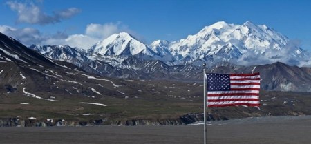
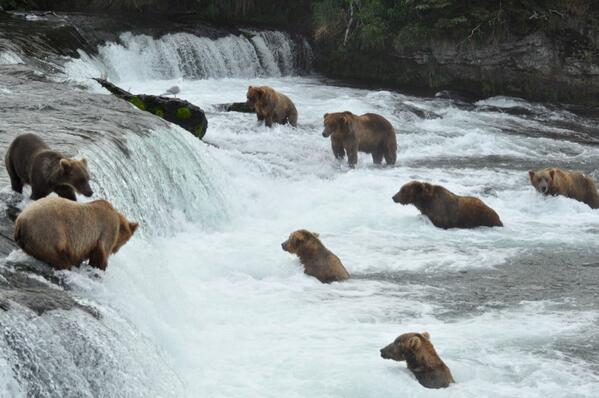
All of that came back as I watched Jason Ching’s film, “Salmon Research at Iliamna Lake, Alaska 2013,” a simple six-minute compilation of shots taken with modern electronic cameras, including the hardy little GoPros, and with assistance from a DJI Phantom Quadcopter drone.  Wow, what we could have captured with that equipment!

Ching’s description of the film:

This video showcases the scenery of Iliamna Lake and shows some of the 2013 research of the Alaska Salmon Program’s Iliamna Lake research station, one of four main facilities in Southwest Alaska . Established in the 1940’s, the Program’s research has been focused on ecology and fisheries management relating primarily to salmon and the environment in Bristol Bay, Alaska. Check out our program at: fish.washington.edu/research/alaska/

Filmed and edited by Jason Ching
Additional footage provided by Cyril Michel

Song:
“The long & quiet flight of the pelican” by Ending Satellites (endingsatellites.com)

Additonal Information:
Shot on a Canon 5d Mark II, Canon T3i, GoPro Hero 2 and GoPro Hero 3
DJI Phantom Quadcopter

JasonSChing.com

I am very grateful to be a part of such a long standing, and prominent program that allows me to work in the field in such an incredible setting with fantastic folks. This is the second video I created, the first one in 2012, to merely show family and friends back at home what I’ve been up to during the summer. This video was often shot between, or during field sampling events so a special thanks goes out to all those who supported me by continuing to work while I fiddled with camera gear.

Do you really want to get kids more interested in science?  Show them this stuff.  Scientists get the front seats on cool stuff — and they often get paid to do it, though they won’t get rich.

Researching life, and rocks, geography and landscape, and water resources, one may be alone in a desert, or a desert of human communication.  Then one discovers just how beautiful the desert  is, all the time.

More:

  • Yes, I know; Indian rice grass has been renomenclaturedAchnatherum hymenoides (Roemer & J.A. Shultes) Barkworth, or Stipa hymenoides Roemer & J.S. Shultes, or Oryzopsis hymenoides (Roemer & J.S. Shultes) Ricker ex Piper.  It is the State Grass of Utah

Reflections in a window on the wild

January 29, 2014

From the U.S. Department of Interior: Really cool reflection photo from America's largest national park: @WrangellStENPS in #Alaska. pic.twitter.com/WHUYkgJNTH

From the U.S. Department of Interior: Really cool reflection photo from America’s largest national park: @WrangellStENPS in #Alaska. pic.twitter.com/WHUYkgJNTH

Wrangell-St. Elias is our largest National Park? At 20,587 square miles, it’s about 80% as large as West Virginia, and larger than nine other states.

Just the facts:

Wrangell–St. Elias National Park and Preserve is a United States national park and national preserve managed by the National Park Service in south central Alaska. The park and preserve was established in 1980 by the Alaska National Interest Lands Conservation Act.[3] This protected area is included in an International Biosphere Reserve and is part of the Kluane/Wrangell-St. Elias/Glacier Bay/Tatshenshini-Alsek UNESCO World Heritage Site. The park and preserve form the largest area managed by the National Park Service in the United States by area with a total of 13,175,799 acres (20,587.19 sq mi; 53,320.57 km2). The park includes a large portion of the Saint Elias Mountains, which include most of the highest peaks in the United States and Canada, yet are within 10 miles (16 km) of tidewater, one of the highest reliefs in the world. Wrangell-St. Elias borders on Canada’s Kluane National Park and Reserve to the east and approaches the U.S. Glacier Bay National Park to the south. The chief distinction between park and preserve lands is that sport hunting is prohibited in the park and permitted in the preserve. In addition, 9,078,675 acres (3,674,009 ha) of the park are designated as the largest single wilderness in the United States.

Wrangell-St. Elias National Monument was initially designated on December 1, 1978 by President Jimmy Carter using the Antiquities Act, pending final legislation to resolve the allotment of public lands in Alaska. Establishment as a national park and preserve followed the passage of the Alaska National Interest Lands Conservation Act in 1980. The park, which is bigger than the nation of Switzerland, has long, extremely cold winters and a short summer season. It supports a variety of large mammals in an environment defined by relative land elevation. Plate tectonics are responsible for the uplift of the mountain ranges that cross the park. The park’s extreme high point is Mount St. Elias at 18,008 feet (5,489 m), the second tallest mountain in both the United States and Canada. The park has been shaped by the competing forces of volcanism and glaciation. Mount Wrangell is an active volcano, one of several volcanoes in the western Wrangell Mountains. In the St. Elias Range Mount Churchill has erupted explosively within the past 2000 years. The park’s glacial features include Malaspina Glacier, the largest piedmont glacier in North America, Hubbard Glacier, the longest tidewater glacier in Alaska, and Nabesna Glacier, the world’s longest valley glacier. The Bagley Icefield covers much of the park’s interior, which includes 60% of the permanently ice-covered terrain in Alaska. At the center of the park, the boomtown of Kennecott exploited one of the world’s richest deposits of copper from 1903 to 1938, exposed by and in part incorporated into Kennicott Glacier. The mine buildings and mills, now abandoned, compose a National Historic Landmark district.

More:


Happy birthday Arctic National Wildlife Refuge; 53 years

December 6, 2013

Icy day here in Dallas, we missed a lot of dates that should have been commemorated.

Let’s catch this one:  The Arctic National Wildlife Refuge (ANWR) was created 53 years ago today in the administration of Dwight Eisenhower, by Interior Secretary Fred A. Seaton.

Happy 53rd birthday to the Arctic National Wildlife Refuge! @USFWSHQ @USFWSRefuges #Alaska pic.twitter.com/2popb7EAvz

Photo probably not taken this week:  From the US Department of Interior: Happy 53rd birthday to the Arctic National Wildlife Refuge! @USFWSHQ @USFWSRefuges #Alaska pic.twitter.com/2popb7EAvz

ANWR finds itself the center of controversy, now, because of the possibility of oil underneath it, and the difficulty of getting that oil without destroying wildlife habitat, or the possibility of destructive oil spills.  For an understanding of the issues, visit ANWR’s website and the non-partisan discussion there.

Odd that land so severely beautiful, so far out of the way and so difficult to master, has its fate decided in marble halls in Washington, D.C., 3,172 miles distant. The United States is a big, sprawling nation.

Information on the ANWR:

History and Culture

Refuge Establishment: Legislation and Purposes

The Arctic Refuge was established in 1960 and expanded in 1980.


Refuge History

The Arctic Refuge has been providing for the physical and emotional well-being of humans for many thousands of years. It remains an important resource to help sustain local Eskimo and Indian cultures. The Refuge continues to be valued, even by those who never travel within it’s borders, as a symbol of America’s vast and remote wilderness – a place of inspiration and beauty – a promise for the future for all Americans.

Local Cultures

The lands of the Arctic Refuge continue to support the Inupiat Eskimo and Gwich’in Indian peoples who have lived here for centuries.

More:  

3,172 miles between the Arctic National Wildlife Refuge and Washington, D.C.

3,172 miles between the Arctic National Wildlife Refuge and Washington, D.C.


Bering land bridge in autumn

September 23, 2013

World and U.S. history classes should be long past this point, but the photo just recently surfaced:

Bering Land Bridge National Preserve, Department of Interior

From America’s Outdoors: Bering Land Bridge National Preserve – Gone are the shockingly bright pinks, yellows and purples of summer, replaced by deeper and darker reds, yellows, greens and the beginnings of brown, all of equal vibrancy and beauty. And soon, as the 34 degree weather and diminishing daylight would lead us to believe, a blanket of white will fall upon the landscape. Enjoy the change of seasons wherever you may be!

Bering Land Bridge National Preserve? Did you even know there was such a thing?  Part of our public lands, your tax dollars at work.

Not a place for a Sunday drive.  There are no roads to get to the place.  For students, this site offers a lot of photos and interesting stuff for projects in history (human migrations) and geography (land forms, lava flows, migration routes, wilderness).

More:

Tors of Serpentine, in the Bering Land Bridge National Preserve, Alaska - NPS photo

Tors of Serpentine, in the Bering Land Bridge National Preserve, Alaska – NPS photo


Mountain goat nemeses everywhere!

August 12, 2013

Normally I might just let this beautiful photo slide by without comment.

In this case, I find this particularly frustrating.  See that creature?  That’s the same goat that blocked my trail in Glacier National Park.  I’m sure of it.  I’d recognize those beady eyes and horns anywhere! (See the first story linked to in the “more’ section; maybe this goat stopped in Washington on the way to Alaska.)

He’s probably in Alaska now under the Federal Goat Protection Program.

Harding Icefield Trail @KenaiFjordsNPS. #alaska pic.twitter.com/yozsSLnrcD

Interior US Dept of Interior 6h Caption from the Department of Interior: That’s quite the hike to the top. Harding Icefield Trail @KenaiFjordsNPS. #alaska pic.twitter.com/yozsSLnrcD

He probably thinks he’s safe there at Kenai Fjords National Park.  Ha!  He’s farther away, but that just means I have farther to travel to find him!

I’m taking a longer telephoto, a wide angle, and a first aid kit, next time.  I’ll be prepared!

More:


Unintentional dry humor from CBO; don’t make a Denali out of a molehill, though

June 21, 2013

A mountain by any other name would be just as high. Image of Denali from Tiny Green Cabins

A mountain by any other name would be just as high. Image of Denali from Tiny Green Cabins

I get e-mail from the Congressional Budget Office.  I asked them to keep me posted on the studies they do, and they have.

Today, this:

S. 155, a Bill to Designate a Mountain in the State of Alaska as Denali

cost estimate

June 21, 2013
read complete document  (pdf, 27 kb)

As ordered reported by the Senate Committee on Energy and Natural Resources on June 18, 2013.

CBO estimates that enacting this legislation to name a peak in Alaska would have no significant impact on the federal budget and would not affect direct spending or revenues; therefore, pay-as-you-go procedures do not apply. S. 155 contains no intergovernmental or private-sector mandates as defined in the Unfunded Mandates Reform Act and would not affect the budgets of state, local, or tribal governments.

Calling a mountain by its name won’t affect the budget?  Good news, I’m sure.  Shakespeare was right.

The testimony of National Park Service Deputy Director Peggy O’Dell is instructive:

STATEMENT OF PEGGY O’DELL, DEPUTY DIRECTOR FOR OPERATIONS, NATIONAL PARK SERVICE, DEPARTMENT OF THE INTERIOR, BEFORE THE SUBCOMMITTEE ON NATIONAL PARKS OF THE SENATE ENERGY AND NATURAL RESOURCES COMMITTEE, CONCERNING S. 155, TO DESIGNATE A MOUNTAIN IN THE STATE OF ALASKA AS DENALI.

April 23, 2013

Mr. Chairman, thank you for the opportunity to present the Department of the Interior’s views on S. 155, a bill to designate a mountain in the State of Alaska as Denali.

The National Park Service appreciates the long history and public interest for both the name Mount McKinley and the traditional Athabascan name, Denali. The Department respects the choice made by this legislation, and does not object to S. 155.

Located in what is now Denali National Park and Preserve, the highest peak in North America has been known by many names. The National Park Service’s administrative history of the park notes that, “The Koyukon called it Deenaalee, the Lower Tanana named it Deenaadheet or Deennadhee, the Dena’ina called it Dghelay Ka’a, and at least six other Native groups had their own names for it.

“In the late 18th century various Europeans came calling, and virtually everyone who passed by was moved to comment on it. The Russians called it Bulshaia or Tenada, and though explorers from other nations were less specific, even the most hard-bitten adventurers were in awe of its height and majesty.

“No American gave it a name until Densmore’s Mountain appeared in the late 1880s, and the name that eventually stuck—Mount McKinley—was not applied until the waning days of the nineteenth century,” a gesture of support to then-President William McKinley.

In 1975, the State of Alaska officially recognized Denali as the name of the peak, and requested action by the U.S. Board on Geographic Names to do the same.

In 1980, Congress changed the name of Mount McKinley National Park to Denali National Park and Preserve (P.L. 96-487, Section 202), but did not act on the name change for the mountain.

In Washington, Congress designates mountains.  In Alaska, mountains designate you.

More:

Mount McKinley

Near-antique poster advertising Ranger Services at the National Park Formerly Known as Mount McKinley. Photo by Kirt Baab


Fireworks for James Madison’s birthday! Aurora borealis in Alaska, March 16, 2013

March 22, 2013

Fireworks for James Madison’s birthday?

Loren Holmes photo of Aurora borealis over Eureka, Alaska, March 16, 2013

Loren Holmes photograph straight up of Aurora borealis over Eureka, Alaska, on March 13, 2013. AlaskaDispatch.com

I love fireworks.  Kathryn and I have been known to drive a couple hundred miles to see a good show.  Fireworks in honor of the guy who gave us the Constitution and the First Amendment (and much more), seems a great idea to me.

But no one did it . . .

Sometimes the Sun, Moon, stars and planets conspire.

Here’s one of the best, most inspiring five minutes you’ll spend this week. Look what the Sun sent us, filmed in time-lapse glory above Eureka, Alaska, on March 16, 2013, the anniversary of James Madison’s birthday; from AlaskaDispatch.com:

A timelapse of the Aurora Borealis, Northern Lights, over Eureka, Alaska on March 16, 2013. Taken with a Canon 5D Mark III and 24mm f/1.4 and 70-200 f/2.8 lenses. Compiled from 3800 images, with exposures between 2 seconds and 30 seconds.

Loren Holmes, the photographer, provides a more poetic description of the lights he filmed, and more scientific, too, at AlaskaDispatch.com.

AlaskaDispatch.com provided a slide show of Holmes’s better photos, too.

Tip of the old scrub brush to Dr. M. P. Bumsted.

More:


Photos from just another day at Denali . . .

August 15, 2012


Interior Dept photo, America's Great Outdoors, Denali National Park and Preserve

Interior Department photo, America’s Great Outdoors, at Denali National Park and Preserve; photo caption from AGO said, “We’re not sure it’s possible to take a bad photo up there!”  Click for larger view.

More:

Update:  Interior tweeted another photo later today.

Denali Wildflower, U.S. Department of Interior

From the U.S. Department of Interior Tweet: This morning we gave you an amazing shot of #Denali. Would you believe this one is from the same place? Whether large or small, beauty in Denali is everywhere you look. #Alaska

Can someone identify the flower?


“Does it get better than this?” U.S. flag and Denali

August 10, 2012

Instagram from the Department of Interior, yesterday:

U.S. flag and Denali on an almost-clear day; Department of Interior photo, August 2012 - public domain

U.S. flag and Denali on an almost-clear day; Department of Interior photo, August 2012 – public domain

usinterior Tweeted, “Does it get any better than this?”

Denali, also known as Mt. McKinley, is the highest point in North America, 20,320 feet (6,194 m) above sea level.  Measured base to peak, it’s the tallest mountain on land on Earth — Everest and other Himilayan peaks rise from a very high plateau.  Denali is high enough that it makes its own weather.  Finding a day when the mountain is not almost completely obscured by clouds is rare, locals say.  Finding an almost-clear view, with blue sky in the background, is a cause for photographer excitement.

You’ll notice straight-line clouds in the sky — condensation trails from passenger jets.  I wonder how many flights bend a little to get a better view of the mountain for passengers?  Do big airlines even do that anymore?

Nice shot.  I could learn to like Instagram with more photos of this quality.

Better, it would be nice to be there, taking these shots.

More, including the controversy over the mountain’s name:


January 3, 1959: Welcome, Alaska, and the 49-star flag

January 3, 2012

Alaska Territorial Gov. Bob Bartlett in center, with the 49-star flag (Bartlett was one of Alaska's first U.S. senators).

Alaska Territorial Gov. Bob Bartlett in center, with the 49-star flag (Bartlett was one of Alaska’s first U.S. senators).

The great service at the New York Times site, the Learning Network, notes the 1959 Dwight Eisenhower proclamation of Alaska as the 49th state, and the unveiling of the 49-star flag:

On Jan. 3, 1959, President Dwight Eisenhower signed a proclamation admitting Alaska to the Union as the 49th state. The New York Times noted that the signing included the unveiling of the new 49-star American flag.

The land that became Alaska came into U.S. possession in 1867, when William Seward, secretary of state under President Andrew Johnson, negotiated a deal to buy the 586,000-square-mile area from Russia for $7.2 million, less than 2 cents per acre. Seward’s decision was ridiculed in the American press, who saw no potential in the vast, inhospitable and sparsely populated area.

For decades after its purchase, Alaska was derided as “Seward’s folly” or “Seward’s icebox.” This opinion changed in 1896 with the discovery of gold in the neighboring Yukon Territory, which spurred tens of thousands of people to head to Alaska in search of gold. The gold rush also brought about a boom in mining, fishing and trapping.

Though the first statehood bill had been presented to Congress in 1916, there was little desire in either Alaska or Washington for Alaskan statehood until after World War II. During the war, the U.S. established multiple military bases to resist Japan’s attacks on Alaska’s Aleutian Islands and prevent a potential invasion of the mainland. The military activity, along with the completion of a major highway from Montana, led to a large population growth.

In 1946, Alaskans voted in favor of statehood in a referendum and Alaskan delegates began to lobby Congress for statehood. After years of debate, Congress voted in June 1958 to admit Alaska.

Eight months after Alaska’s admission, on Aug. 21, 1957 [should be 1959, no?], Hawaii became the 50th state. The 49-star remained in place until the following July 4, when it was replaced by the now-familiar 50-star flag.

49-star flags were produced only until August 1959, so there are few of them around.  I love this photo of the unveiling of the flag with President Eisenhower:

President Eisenhower and Quartermaster General MG Andrew T. McNamara, with 49-star flag - image from QM foundation

“Quartermaster General MG Andrew T. McNamara and President Eisenhower examine new 49 star flag” – image and caption from the Quartermaster Foundation. (Who are the other two people?  The guy on the right looks to me a bit like is Pennsylvania’s Sen. Hugh Scott.)

It had been about 47 years since the previous state admission (Arizona); people became aware that no law set what the flag should look like.  President Eisenhower issued a directive.

How did the nation survive for 170 years without firm, decisive and conclusive orders on what the flag should look like?  Isn’t it a great story that we went so long without law setting the requirements?

Benny Benson's award-winning flag design for the State of Alaska

Alaska’s flag was designed by 13-year-old Benny Benson

Alaska’s state flag came from the imagination of a 13-year-old Aleut, Benny Benson, winning a contest to design the state’s flag.  Alaska’s flag stands out in any display of U.S. state flags.