Geography from space: Nile at night, a river of light

September 25, 2015

Geography teachers love the Nile Delta because it so well epitomizes what a river delta is — clear demonstration of the delta form, in real photos.

From the International Space Station, the model gets ramped up a bit:

A stunning pic taken by @StationCDRKelly while on @Space_Station shows the Nile River at night http://go.nasa.gov/1iAE3EV

Twitter caption: A stunning pic taken by @StationCDRKelly while on @Space_Station shows the Nile River at night http://go.nasa.gov/1iAE3EV

The Nile becomes a river of light, showing the advance of electrified human settlement along the banks, and providing stark contrast to the unlighted desert on either side of the river.

What other cities, landmarks, or geographical features can you identify in the photo?


Warning signs in Texas

September 7, 2014

On several Texas rivers one may rent a large tire inner tube, to float down the river on a good day.

Safety instructions sometimes are minimal, but effective.

Safety rules at a river float rental company, location unknown. Photo via Cathy Ordemann

Tip of the old scrub brush to Cathy Ordemann.


Electricity in the air, times 2

September 1, 2013

Spectacular photo of Glen Canyon Dam, in the early morning, with a thunderstorm to the north.  This photo was taken close to the spot where Norman Rockwell painted the dam about 40 years ago.

 Electricity is in the air at Glen Canyon! Although the Glen Canyon Dam produces hydroelectric power around the clock, an early morning thunderstorm really cranked up the voltage earlier this month. Use caution when planning your upcoming outdoor activities as intense thunderstorms are common this time of year. (Photo Credit: David Bailey)

Electricity is in the air at Glen Canyon! Although the Glen Canyon Dam produces hydroelectric power around the clock, an early morning thunderstorm really cranked up the voltage earlier this month. Use caution when planning your upcoming outdoor activities as intense thunderstorms are common this time of year. (Bureau of Reclamation/Interior Facebook entry; photo Credit: David Bailey)

More:

Norman Rockwell's tribute to the Glen Canyon Dam.  Bureau of Reclamation image

Norman Rockwell’s tribute to the Glen Canyon Dam. Bureau of Reclamation image


Geographic jokes, on the Colorado and Green Rivers?

July 29, 2013

Can the scientist appreciate the beauty of creation as much as the non-scientist religious person?

Can you get the joke in this photo, without a smattering of knowledge of geography, and languages?  Or am I looking at it wrong?

Confluence of the Green and Colorado Rivers, in Canyonlands National Park.  Photo by Jim Collins

Confluence of the Green and Colorado Rivers, in Canyonlands National Park. Photo by Jim Collins, posted on Facebook by Canyonlands National Park

It’s a joke on a planetary scale, if not a cosmic one.

(Hints:  This is a photo looking from the north, I think; “Colorado” means “red” in Spanish.)

Update: Okay, Mr. Higginbotham convinced me.  We’re looking from the west, and that’s the Colorado coming from the top of the picture, and the Green coming from the bottom left; then the conjoined streams flow away, to the bottom right.  So, in the photo, the Colorado River is, appropriately, red, while the Green River is, fittingly, green

Not a majestic joke by Mother Nature, but a poetic way to remind us of the names of these rivers.

Poetry that might make us smile, too.

(It’s rare that these rivers run such dramatically different colors, especially with the Colorado that red, that far north.)

Google Maps aerial photo of the Confluence of the Green and Colorado Rivers; match the geography with the other photo, and note the labels on this one.  Tip of the old scrub brush to Mr. Higginbotham.

Google Maps aerial photo of the Confluence of the Green and Colorado Rivers; match the geography with the other photo, and note the labels on this one. Rotate this picture 90 degrees to the left, it matches up better.   Tip of the old scrub brush to Mr. J. A. Higginbotham.

More:


A study in geography: The Red River of Texas – film from Texas Parks & Wildlife

December 26, 2011

Seven minutes on the Red River of the southern U.S., the fickle border of Texas and Oklahoma, the river of story and legend.  Good for a map study, good for the fun of it — how much do you really know about the Red River?

George Washington did not cross the Red River; George Washington may not have known the river even existed.  His loss.


Hoaxsters frustrated: Alert called off at Nebraska nuclear power plant

July 15, 2011

Sometimes time and events just catch up to the hoaxsters.

In Nebraska, on Wednesday July 14, the Cooper nuclear generating station of the Nebraska Public Power District (NPPD) ended it’s “notification of unusual event” as floodwaters of the Missouri River retreated from the site.

Walkways for flood at Fort Calhoun Nuclear Station, 2011

Publicity photo from Omaha Public Power District

According to the Associate Press report, the alert for the nuclear power plant at Fort Calhoun remains in effect.  Fort Calhoun is upriver from Cooper, and lower in elevation in relation to the Missouri River.  Fort Calhoun also was offline and in cold shutdown when the alert was posted, because it had been in a refueling operation.  Fort Calhoun is operated by Omaha Public Power district (OPPD).

NRC Chairman tours Fort Calhoun Nuclear Generating Station

Publicity photo from OPPD

No damage was done to the reactor at either site.  Operations continued at Cooper.

Rumors of a serious incident aroused conspiracy nuts when a hoax report out of Pakistan claimed the Russian nuclear agency had said the Fort Calhoun plant was in meltdown.

NRC chair tours Fort Calhoun NGS in Nebraska, 2011

No meltdown. Photo from OPPD

How with the hoaxsters spin it now?

More, resources:

Earlier at Millard Fillmore’s Bathtub:


Troops who fought in two wars now protect public against Missouri River flood and nuclear accident

July 10, 2011

Hoax claims died down a bit across the blogosphere, but the Missouri River still floods, and the two Nebraska nuclear power plants on the Missouri still face threats from the flood.

Comes news via the Omaha World-Herald that members of Nebraska’s and Iowa’s Air National Guard — many of them veterans of Iraq or Afghanistan — patrol the levees, helping protect against floods.  Among points of special concern are the nuclear power plants at Fort Calhoun and Cooper.

The military helicopter’s black shadow dances on an engorged Missouri River as the aircraft slowly loops the flood-encircled Fort Calhoun Nuclear Station — the same left-leaning turns the pilot navigated two days prior.

Warrant Officer Boe Searight, 32, with the Nebraska Air National Guard wants the infrared camera mounted under the chopper to record similar flood scenes for levee experts on the ground to compare.

He and his colleague Chief Warrant Officer 2 Eric Schriner also are looking for new signs of trouble for the flooded plant.

“Keep daily eyes on it and see if anything changes,” says Schriner, 31.

Far below, on mosquito-infested riverbanks, two-person crews with the Nebraska National Guard and Iowa National Guard patrol the Omaha and Council Bluffs levees in mud-caked boots.

Members of the Guard are the front-line levee watchers in an operation that clearly has high stakes: Levees protect about 40,000 people from homelessness in the neighboring river cities — as well as the region’s key airport.

The levee watchers are out there right now — three shifts a day, all week, searching for gopher holes, chasing away sightseers who could fall from the levees, and checking for signs of water seepage.

More than 130 men and women with the Nebraska Army and Air National Guard work each day for flood duty, along with 120 from the Iowa Army and Air National Guard.

The idea is to spot trouble early. Levees don’t always give notice before they rupture, but more often than not they do.

If trouble is spotted, steps can be taken to shore up or boost a weakened levee.

Good to know.  Still no nuclear incident along the lines of the hoax report from the Pakistani outlet alleged to be based on a report from a Russian agency — which is also good news — but no cause for abatement of overall concern.

Sometimes safety preparations work.  Kudos to the Air National Guards, to the Nuclear Regulatory Agency, and to the companies who own  the power plants.  May their work continue to pay off in no nuclear incidents.

Idaho Samizdat noted earlier that the bizarre conspiracy theories haven’t borne out as accurate or true in the least:

The flooding situation in Nebraska has been the subject of bizarre conspiracy theories originating in Russia and Pakistan alleging that a meltdown has occurred at Ft. Calhoun and that the government is covering it up.

One U.S. web site, Business Insider, ran with the story as legitimate and set off a huge round of copy cat reports on the Internet.

Reports of a U.S. news blackout are also part of the conspiracy theory even though Nebraska papers such as the Omaha World-Herald and the New York Times have run major stories on measures by the two reactor sites to prevent the flood waters from reaching important infrastructure such as switch yards


Watching the drought roll in at Colorado Bend State Park

July 6, 2011

It took me a couple of tries to figure it out — last week when I told people Kathryn and I were off to Colorado Bend State Park to spend time on the river, several people commented about how much cooler it would be there.

What?  West of Killeen about an hour, ten miles of dusty road outside of Bend, Texas (population 1,637), Colorado Bend is not cooler than Dallas.  It was over 100° F every day we were there, stayed well above 90° most  of the nights.

Kathryn Knowles checking wildflowers, Colorado River, Texas

Kathryn studied wildflowers at a spring at the side of the Colorado River during a break from kayaking; this spring's flow was reduced, but still moist enough to create a near-oasis.

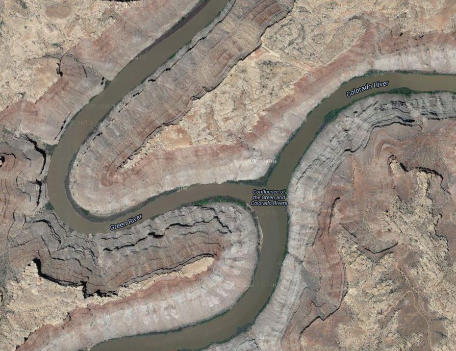
Our well-wishers were geographically confused.  They thought we were headed to the Colorado River in Colorado, not the Colorado River in Texas, which is not the same river at all.  I didn’t bother to check the temperatures in Colorado, but one might be assured that it was cooler along the Colorado River in Colorado than it was along the Colorado River in Texas.

It was a return trip.  We stumbled into the park 16 years ago with the kids, for just an afternoon visit.  The dipping pools  in the canyon fed by Spicewood Springs captivated us.  It took a while to get back, and then the kids were off doing their own thing.

So, just a quick weekend of hiking/camping/kayaking/soaking/stargazing/bird watching/botanical and geological study.   Park officials closed the bat caves to human traffic in hope of keeping White Nose Syndrome from the bats; we didn’t bother to sign up for the crawling cave tour through another.

Ed Darrell at Colorado Bend State Park, Texas

The author, still working to master that Go-Pro camera on the hat -- some spectacular shots, but I don't have the movie software to use it all; you know it's hot when SPF 75 sunscreen is not enough.

What did we see?  Drought has a firm grip on Texas, especially in the Hill Country, especially outside of Dallas.  The Colorado River  is mostly spring fed; many of the springs are dry.  No water significant water flowed through the park while we  were there — kayak put-ins have been reduced to the downriver-most ramp, and the bottom of the boat launch ramp is three feet above water.  Gorman Falls attracts visitors and scientists, but the springs feeding it are about spent this year — just a few trickles came over the cliff usually completely inundated with mineral-laden waters.

Drought produces odd things.  The forest canopy around the park — and through most of the Hill Country we saw — is splattered with the gray wood of dead trees, many of which at least leafed out earlier this spring.  The loss to forests is astonishing.  Deer don’t breed well in droughts; deer around the campsites boldly challenge campers for access to grasses they’d ignore in other seasons.  One ranger said he hadn’t seen more than about three fawns from this past spring, a 75% to 90% reduction in deer young (Eastern White Tail, the little guys).  Raccoons are aggressively seeking food from humans, tearing into tents and challenging campers for food they can smell (lock your food in the car!).  Colorado Bend is famous for songbirds, including the endangered Golden Cheeked Warbler, and the elusive, spectacular painted bunting.  But the most commonly-sighted birds this year are turkey vultures, dining on the young that didn’t make it healthy into the summer and won’t survive until fall.

Warming denialists’ claims of “not so bad a drought” ring out as dangerous, wild delusion.  (By actual measurement, Texas average rainfall the past nine months was 8.5 inches, the driest ever recorded in Texas, shattering the old record drought of 1917).

Great trip.  Kathryn’s menu planning was spectacular.  The old Coleman stove  — a quarter century old, now, with fuel almost that old — performed like a champ even without the maintenance it needs (later this week).  Other than the hot nights, it was stellar.

Stellar.  Yeah.  Stars were grand.  It was New Moon, a happy accident.  A topic for another post, later.  Think, “Iridium.”

So posting was slow over the weekend.  How far out in the Hill Country were we?  Neither one of us could get a bar on our phones.  We were so far out the Verizon Wireless guy was using smoke signals.

Thoreau was right, you know.


Chronic drought complicated by chronic denialism

May 26, 2011

Which is worse:  To be in the depths of a drought, or to deny drought where it exists?

I ask the question because, as one cannot tear one’s eyes away from a train wreck about to occur, I watch Steve Goddard’s blog.  Occasionally Steve or one of his fellow travelers says something so contrary to reality or fact that I can’t resist pointing it out.

In some discussion over there, Goddard suggested that because there is above-average snowpack around Salt Lake City and in Northern Utah, Lake Powell’s decade-long struggle with extreme drought is over.  Therefore, to Goddard, global warming does not exist.

(No, I’m not really exaggerating.  Seriously.  Go look.  No one there seems to have ever had a course in logic, nor in English composition and essay writing.  If Al Gore got svelte, one suspects half the commenters there would never be able to speak again.)

It is true that this year, contrary to the past decade, snowpack is high along the Wasatch Front and in the Uinta Mountains of Utah, and in Wyoming and Colorado areas that drain into the Green and Colorado Rivers.  Consequently, forecasters say that Lake Powell may gain a few feet of depth this year.  Powell is down about 50 feet, however, and even a record snowpack won’t erase the effects of drought on the lake.  (Yeah, I know:  The Wasatch doesn’t drain into the Colorado system — it drains to the Great Salt Lake, as indeed do many of the streams that have great snowpack in Utah — so a lot of the record snowpack won’t get within 400 miles of Lake Powell.  That’s geography, and it would be one more area that commenters would embarrass themselves in.  Don’t ask the pig to sing if you aren’t going to spend the time to teach it; if you need the aphorism on teaching pigs to sing, look it up yourself.)

Since Lake Powell won’t lose a lot of elevation this year, the Goddardites (Goddardians?  Goddards?  Goddardoons?) pronounce the U.S. free of drought.

Right.

Check it out for yourself, Dear Reader.  Here’s an animation from the National Drought Center, showing drought measurements in the contiguous 48 states plus Alaska and Hawaii, over the past 12 weeks:

Drought in the U.S., 12 weeks ending May 17, 2011, National Drought Mitigation Center, U of Nebraska-Lincoln

Drought in the U.S., 12 weeks ending May 17, 2011, National Drought Mitigation Center, U of Nebraska-Lincoln - click on map for a larger version at the Drought Monitor site.

Here’s the drought outlook map from the Climate Prediction Center at NOAA:

U.S. Seasonal Drought Outlook Map, released May 19, 2011, NOAA and the Climate Prediction Center

U.S. Seasonal Drought Outlook Map, released May 19, 2011, NOAA and the Climate Prediction Center - click image for a larger version at NOAA's site.

It would be wonderful were these droughts to break soon.  But that is very unlikely.

So, why would anyone deny it?

Then, just to indicate the bait-and-switch logic these guys use, Goddard came back with a claim that the 1956 drought in Texas was worse, as if that means the current drought doesn’t exist.  Fore reasons apparent only to those whose heads get pinched by tinfoil hats, he also notes the CO2 levels for 1956.  I think I know what point he’s trying to make, but someone should tell him that apples are not oranges, and comparing apples and oranges to pomegranates doesn’t increase the supply of tennis balls.

Let’s just stick to the facts.  The experts who must operate the dams and lakes and get water to Mexico on schedule say the drought along the Colorado persists.  Who are we to gainsay them?

Resources:  

GEOSat photos of Lake Powell and drought, 2000 to 2004 - Dr. Paul R. Baumann, SUNY - Oneonta College

GEOSat photos of Lake Powell and drought, 2000 to 2004 - Dr. Paul R. Baumann, SUNY - Oneonta College


Lake Powell drought ended? Don’t trust the warming denialists’ predictions

April 20, 2011

Every once in a while a factoid crosses the desk and/or mind of an otherwise badly-informed person who denies global warming is a problem, and without bothering to check the significance of the factoid, the denialist world ramps up The Crazy Rant.

And so, Steve Goddard (who should need no introduction) seized upon a chart that shows a momentary uptick in water in drought-ravaged Lake Powell.  Ignoring more than 50 years of history of the river flows, Goddard pronounced the case for global warming dead.

Former AGW poster child Lake Powell water levels have been rising rapidly over the last few years.

Goddard’s claim is a grand example of the triumph of ignorance over experience, science, data, history and the law, in discussions of climate change.

Did Goddard read his own chart?  It shows a decline in lake level from 2010.

Lake Powell levels, charted by Steve Goddard?

Goddard’s own chart shows a decline in Lake Powell’s March 20 level, from 2010; did he look at the chart? Even Goddard’s source says, “Lake Powell is 89.99 feet below Full Pool (Elevation 3,700).”

“Full pool” level is 3,700 feet elevation (the height of the surface of Lake Powell above sea level).  Goddard’s chart shows the lake hasn’t been at that level since 2000 (and it was declining for some time prior to that).  Goddard’s chart shows four years of rise compared to seven years of decline.

The U.S. Bureau of Reclamation isn’t as optimistic as the warming deniers, noting that drought conditions continue on the Colorado Plateau.

 Upper Colorado River Basin Hydrology

In the Upper Colorado River Basin during water year 2010, the overall precipitation accumulated through September 30, 2010 was approximately 90% of average based on the 30 year average for the period from 1971 through 2000.  For Water Year 2011 thus far, the estimated monthly precipitation within the Upper Colorado River Basin (above Lake Powell) as a percentage of average has been: (October – 135%, November – 95%, December – 225%, January – 50%, February – 100%, March – 90%)

The Climate Prediction Center outlook (dated March 17, 2010) for temperature over the next 3 months indicates that temperatures in the Upper Colorado River Basin are expected to be above average while precipitation over the next 3 months is projected to be near average in the northern reaches of the basin while below average in the southern reaches of the basin.

Upper Colorado River Basin Drought

The Upper Colorado River Basin continues to experience a protracted multi-year drought.  Since 1999, inflow to Lake Powell has been below average in every year except water years 2005 and 2008.  In the summer of 1999, Lake Powell was close to full with reservoir storage at 23.5 million acre-feet, or 97 percent of capacity.  During the next 5 years (2000 through 2004) unregulated inflow to Lake Powell was well below average.  This resulted in Lake Powell storage decreasing during this period to 8.0 million acre-feet (33 percent of capacity) which occurred on April 8, 2005.  During 2005, 2008 and 2009, drought conditions eased somewhat with near or above average inflow conditions and net gains in storage to Lake Powell.  2011 will be another above average inflow year so drought conditions are easing somewhat in the Colorado River Basin. As of April 18, 2011 the storage in Lake Powell was approximately 12.73 million acre-feet (52.3 % of capacity) which is below desired levels.  The overall reservoir storage in the Colorado River Basin as of April 18, 2011 is approximately 31.40 million acre-feet (52.8 % of capacity).
Updated: April 19, 2011

Rick Clayton

Goddard isn’t the first denier to stumble down this path — but can’t they learn from the stumblings of others?  Remember Australia’s “Jo Nova,” who used a photograph of drought-stricken Glen Canyon Dam and environs to claim that warming was not posing problems?  Remember Anthony Watts claiming Lake Powell as a “good proxy” for water in the entire area, and seizing on a momentary uptick?  (Oh, yeah — Watts based his glee on a Goddard note — even repeating Goddard’s error that Lake Powell’s low levels were due to increased use of water in Los Angeles . . .)

Oy.  Do they ever learn?

More, Resources:

The sources from my earlier post on Lake Powell still edify those who bother to read them:

More current sources:


%d bloggers like this: